|
search place name
|
||
Al Maḩrūqah (Mont-Liban, Lebanon)Al Maḩrūqah is a town in the Mont-Liban region of Lebanon. An overview map of the region around Al Maḩrūqah is displayed below.
regional and 3d topo map of Al Maḩrūqah, Lebanon ::

Al Maḩrūqah airports ::
The nearest airport is BEY - Beirut Rafic Hariri Intl, located 33.6 km south west of Al Maḩrūqah.
Other airports nearby include DAM - Damascus Intl (88.1 km south east), RPN - Rosh Pina Mahanaim I Ben Yaakov (109.9 km south), HFA - Haifa (145.5 km south west), LTK - Latakia Bassel Al Assad Intl (161.4 km north), Nearby towns ::
Muql al Khaff (1.5km east) //
Qanāt Bakīsh (1.9km north) //
As Saqy (1.5km west) //
Al Manbūkh (1.9km south) //
Wādī ad Dulb (2.4km south east) //
Al ‘Ālī (2.4km south east) //
Al Mīdān (2.4km south east) //
Şannīn (2.4km south east) //
Ar Ruʼaysah (2.4km south west) //
Ḩayy al Balāţah (2.4km south west) //
Ḩayy Mār Sāsīn (2.4km south west) //
Biskintā (2.7km west) //
Al Mīdān (3.1km west) //
Al Ghābah (3.1km west) //
Marj Biskintā (3.1km west) //
Ḩaqlat as Sayyid (4.0km north west) //
Al Ḩabash (4.0km south west) //
Ash Shaqīf (3.6km north west) //
Ar Ruʼaysah (3.6km north west) //
Buq‘ātat an Nahr (3.6km north west) //
Ḩayy Bayt Bū Nādir (3.6km south west) //
Ḩayy Mār Rūkuz (3.6km south west) //
Ḩayy ad Dihlīz (4.8km north west) //
Al Qal‘ah (4.8km north west) //
As Suhūm (4.8km north west) //
Al ‘Azr (4.8km north west) //
Az Zīrah (4.8km north west) //
Shāwiyat az Zammār (4.6km west) //
Kafrtayh (4.6km west) //
[all distances 'as the bird flies' and approximate] 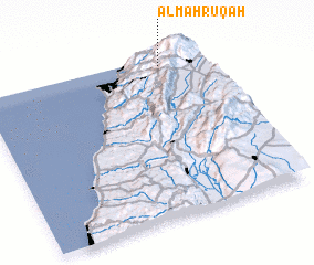 Places with similar names to Al Maḩrūqah, Lebanon ::
// Almberg (NO)
// Al Mirekh (SD)
// Al Maḩrūqah (LY)
// Almayrac (FR)
// Almberg (SE)
// Al Maḩraq (YE)
// Almarco (PH)
// Al Markh (BH)
// Al Murayqī (YE)
// Alum Rock (US)
Disclaimer :: Information on this page comes without warranty of any kind |
||
|
Where is Al Maḩrūqah? Elevation and coordinates ::
Latitude (lat): 33°57'0"N Longitude (lon): 35°49'0"E
Elevation (approx.): 1503m (map arrows pan, magnifying glasses zoom) |
||
|
Visiting Al Maḩrūqah? Hotel/Accommodation ::
Book a hotel in Al Maḩrūqah Travel Guide ::
Buy a travel guide for Lebanon rental cars ::
car rental offers GPS waypoint ::
download a GPX waypoint (PoI) of Al Maḩrūqah for your GPS receiver
|
||