|
search place name
|
||
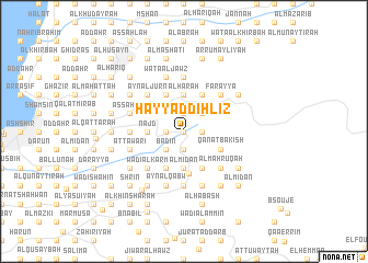
Ḩayy ad Dihlīz (Mont-Liban, Lebanon)Ḩayy ad Dihlīz is a town in the Mont-Liban region of Lebanon. An overview map of the region around Ḩayy ad Dihlīz is displayed below.
regional and 3d topo map of Ḩayy ad Dihlīz, Lebanon ::
Ḩayy ad Dihlīz airports ::
The nearest airport is BEY - Beirut Rafic Hariri Intl, located 32.7 km south west of Ḩayy ad Dihlīz.
Other airports nearby include DAM - Damascus Intl (92.9 km south east), RPN - Rosh Pina Mahanaim I Ben Yaakov (112.9 km south), HFA - Haifa (147.3 km south west), LTK - Latakia Bassel Al Assad Intl (158.0 km north), Nearby towns ::
Al Qal‘ah (0.0km north) //
Al ‘Azr (0.0km north) //
Az Zīrah (0.0km north) //
As Suhūm (0.0km north) //
Al ‘Alālī (1.5km west) //
Al ‘Awjān (1.5km west) //
Ar Ruʼaysah (1.9km south) //
Ḩayy az Zu‘aytirī (1.5km west) //
At Tallah (1.5km west) //
Buq‘ātat an Nahr (1.9km south) //
Al Ksār (1.5km west) //
Mazra‘at Kafr Dhibyān (1.5km west) //
Ash Shaqīf (1.9km south) //
Qaţţīn al Marj (1.5km west) //
Al Ḩarīqah (1.5km west) //
Ḩayy as Sindiyānah (1.5km west) //
Jūrat ad Durdūr (1.5km west) //
Ḩaqlat as Sayyid (1.5km east) //
Al Qanāţir (1.9km north) //
Al Ḩasak (1.6km west) //
Bādīn (2.4km south west) //
Ḩayy al Ba‘l (2.4km south west) //
Ash Shamīs (2.4km south west) //
Buq‘ātah (2.4km south west) //
Al Wādī (2.4km south west) //
Aḑ Ḑay‘ah (2.4km south west) //
Bqa‘Tūtā (2.4km south west) //
Brummānā (2.4km north east) //
Al Mīdān (3.7km south) //
[all distances 'as the bird flies' and approximate]  Places with similar names to Ḩayy ad Dihlīz, Lebanon ::
// Haidlas (DE)
// Hoadleys (US)
// Whittles (US)
// Huatales (HN)
// Hudlice (CZ)
// Hauteluce (FR)
// Whittlesea (ZA)
// Whittlesey (US)
// Hudlice (CZ)
// Whittlesea (AU)
Disclaimer :: Information on this page comes without warranty of any kind |
||
|
Where is Ḩayy ad Dihlīz? Elevation and coordinates ::
Latitude (lat): 33°59'0"N Longitude (lon): 35°47'0"E
Elevation (approx.): 1294m (map arrows pan, magnifying glasses zoom) |
||
|
Visiting Ḩayy ad Dihlīz? Hotel/Accommodation ::
Book a hotel in Ḩayy ad Dihlīz Travel Guide ::
Buy a travel guide for Lebanon rental cars ::
car rental offers GPS waypoint ::
download a GPX waypoint (PoI) of Ḩayy ad Dihlīz for your GPS receiver
|
||