|
search place name
|
||
Kampong Cherok To' Kun Atas (Pulau Pinang, Malaysia)Kampong Cherok To' Kun Atas is a town in the Pulau Pinang region of Malaysia. An overview map of the region around Kampong Cherok To' Kun Atas is displayed below.
regional and 3d topo map of Kampong Cherok To' Kun Atas, Malaysia ::

Kampong Cherok To' Kun Atas airports ::
The nearest airport is PEN - Penang Intl, located 25.4 km west of Kampong Cherok To' Kun Atas.
Other airports nearby include AOR - Alor Setar Sultan Abdul Halim (93.5 km north), IPH - Ipoh Sultan Azlan Shah (108.6 km south east), LGK - Pulau Langkawi Intl (138.0 km north west), PAN - Pattani (174.5 km north east), Nearby towns ::
Kampong Pisang (0.0km north) //
Pekan Baharu (1.8km west) //
Kampong Binjai (1.8km west) //
Kampong Tandok (1.8km west) //
Kampong Cherok To' Kun Bawah (1.8km west) //
Pelandok Jatoh (1.8km west) //
Pagar Teras (2.6km north east) //
Kampong Machang Bubok (2.6km south east) //
Kampong Ayer Merah (3.7km east) //
Kampong Baharu (3.7km west) //
Tanah Liat (4.1km north west) //
Kampong Bukit Minyak (4.1km south west) //
Kampong Kijang (4.1km south west) //
Kampong Alma (4.1km south west) //
Bukit Mertajam (4.1km north west) //
Kampong Berangan Sembilah (4.1km south east) //
Gajah Mati (4.1km south east) //
Kampong Bukit Teh (4.1km south east) //
Kampong Mengkuang Ulu (4.1km north east) //
Batu Lintang (4.1km north west) //
Berapit (4.1km north west) //
To' Suboh (5.2km south west) //
Kampong Keladi (5.2km north east) //
Kampong Besar (5.2km north west) //
Kampong Pandok Labu (5.2km north east) //
Kampong Uma (5.2km north west) //
Sungai Lembu (5.2km north east) //
Kampong Paya (5.2km north west) //
Kampong Pas Tumpang (5.5km east) //
[all distances 'as the bird flies' and approximate] 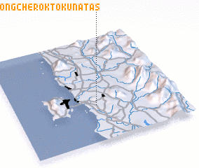 Places with similar names to Kampong Cherok To' Kun Atas, Malaysia ::
// Kampong Cherok To' Kun Bawah (MY)
Disclaimer :: Information on this page comes without warranty of any kind |
||
|
Where is Kampong Cherok To' Kun Atas? Elevation and coordinates ::
Latitude (lat): 5°21'0"N Longitude (lon): 100°30'0"E
Elevation (approx.): 114m (map arrows pan, magnifying glasses zoom) |
||
|
Visiting Kampong Cherok To' Kun Atas? Hotel/Accommodation ::
Book a hotel in Kampong Cherok To' Kun Atas Travel Guide ::
Buy a travel guide for Malaysia rental cars ::
car rental offers GPS waypoint ::
download a GPX waypoint (PoI) of Kampong Cherok To' Kun Atas for your GPS receiver
|
||