|
search place name
|
||
Kampong Sungai Sendok (Johor, Malaysia)Kampong Sungai Sendok is a town in the Johor region of Malaysia. An overview map of the region around Kampong Sungai Sendok is displayed below.
regional and 3d topo map of Kampong Sungai Sendok, Malaysia ::

Kampong Sungai Sendok airports ::
The nearest airport is MKZ - Malacca, located 52.2 km west of Kampong Sungai Sendok.
Other airports nearby include JHB - Johor Bahru Sultan Ismail (122.7 km south east), KUL - Kuala Lumpur Intl (127.2 km north west), XSP - Singapore Seletar (154.6 km south east), DUM - Dumai Pinang Kampai (157.0 km south west), Nearby towns ::
Gerisik (0.0km north) //
Kampong Ujong Tambak (1.9km east) //
Kampong Semasih (1.9km west) //
Kampong Semandau (1.9km west) //
Kampong Berohol (2.6km south east) //
Kampong Parit Jalang (2.6km south west) //
Pancur (3.7km south) //
Kampong Parit Baharu (3.7km west) //
Kampong Parit Raja (4.1km north east) //
Kampong Olak Sepam (4.1km south east) //
Kampong Kelompang (4.1km south east) //
Kampong Terus (4.1km south west) //
Kampong Bukit Katil (4.1km north west) //
Kampong Parit Medan (5.2km north east) //
Kampong Tanggol Aur (5.2km south east) //
Kampong Gerisek (5.2km north west) //
Kampong Sawah Ring (5.2km north west) //
Kampong Sungai Alai (5.2km south west) //
Kampong Parit Bilah (5.6km west) //
Kampong Gelam (5.9km east) //
Kampong Jawa (5.9km south) //
Kampong Sungai Leban (5.9km west) //
Kampong Parit Meriam (5.9km west) //
Kampong Sungai Ikor (5.9km west) //
Bukit Gambir (5.9km west) //
Kundang Ulu (6.7km north east) //
Kampong Raja Pagoh (6.7km south east) //
Kampong Sungai Ranggam (6.7km south west) //
Kampong Sengkang Batu Nineteen (6.7km north west) //
[all distances 'as the bird flies' and approximate] 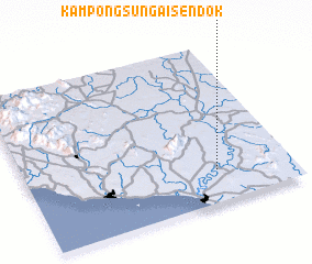 Places with similar names to Kampong Sungai Sendok, Malaysia ::
// Kampong Sungai Sendok (MY)
// Kampong Sungai Sentang (MY)
Disclaimer :: Information on this page comes without warranty of any kind |
||
|
Where is Kampong Sungai Sendok? Elevation and coordinates ::
Latitude (lat): 2°12'0"N Longitude (lon): 102°43'0"E
Elevation (approx.): 15m (map arrows pan, magnifying glasses zoom) |
||
|
Visiting Kampong Sungai Sendok? Hotel/Accommodation ::
Book a hotel in Kampong Sungai Sendok Travel Guide ::
Buy a travel guide for Malaysia rental cars ::
car rental offers GPS waypoint ::
download a GPX waypoint (PoI) of Kampong Sungai Sendok for your GPS receiver
|
||