|
search place name
|
||
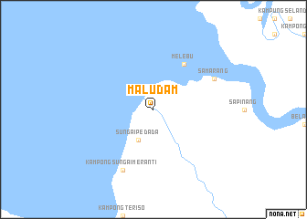
Maludam (Sarawak, Malaysia)Maludam is a town in the Sarawak region of Malaysia. An overview map of the region around Maludam is displayed below.
regional and 3d topo map of Maludam, Malaysia ::
Maludam airports ::
The nearest airport is KCH - Kuching Intl, located 78.5 km west of Maludam.
Other airports nearby include SBW - Sibu (125.7 km north east), SQC - Sintang Susilo (182.1 km south), PNK - Pontianak Supadio (269.3 km south west), BTU - Bintulu (274.6 km north east), Nearby towns ::
Sungai Pedada (4.1km south west) //
Melebu (6.7km north east) //
Kampong Sungai Meranti (8.3km south west) //
Samarang (8.3km north east) //
[all distances 'as the bird flies' and approximate]  Places with similar names to Maludam, Malaysia ::
// Malaodim (TD)
// Mbelatem (GA)
// Mbilatem (GA)
// Mūlī Adīmī (IR)
// Molletambo (PE)
// Mulatambo (PE)
// Mildmay (CA)
// Moltema (AU)
// Maltam (CM)
// Mildam (NL)
Disclaimer :: Information on this page comes without warranty of any kind |
||
|
Where is Maludam? Elevation and coordinates ::
Latitude (lat): 1°39'0"N Longitude (lon): 111°2'0"E
Elevation (approx.): 4m (map arrows pan, magnifying glasses zoom) |
||
|
Visiting Maludam? Hotel/Accommodation ::
Book a hotel in Maludam Travel Guide ::
Buy a travel guide for Malaysia rental cars ::
car rental offers GPS waypoint ::
download a GPX waypoint (PoI) of Maludam for your GPS receiver
|
||