|
search place name
|
||
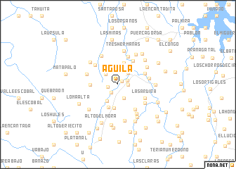
Aguila (Coclé, Panama)Aguila is a town in the Coclé region of Panama. An overview map of the region around Aguila is displayed below.
regional and 3d topo map of Aguila, Panama ::
Aguila airports ::
The nearest airport is HOW - Howard, located 65.2 km east of Aguila.
Other airports nearby include PAC - Panama Marcos A Gelabert Intl (70.0 km east), PTY - Panama City Tocumen Intl (89.8 km east), Nearby towns ::
El Silencio (0.8km north east) //
Jacumilla (1.6km east) //
El Pon La Olla (1.6km north east) //
Las Quebradas (1.6km west) //
El Chorrito (1.7km south west) //
Río Coquillito (2.3km south east) //
La Boca de Uracillo (2.4km north east) //
El Jobo (2.5km north west) //
Piedra Amarilla (3.0km north east) //
El Ají (3.1km south west) //
Palma Real (3.5km north) //
El Coquillo (3.8km south) //
Tierra Buena (3.9km south west) //
Cerro Miguel (4.4km west) //
El Torno Abajo (4.4km north east) //
Los Flaires (4.5km east) //
El Limón (4.7km north) //
El Papayo (4.7km north west) //
Las Postreras (4.8km south east) //
La Sardina (4.8km south east) //
El Hinojal (5.0km east) //
El Higuerón (5.1km south east) //
El Fardal (5.1km west) //
Aguacate (5.2km north west) //
Tres Hermanas (5.4km north) //
Dominical (5.4km north) //
El Torno Arriba (5.3km north east) //
Tornito (5.5km north east) //
La Mona (5.5km south east) //
[all distances 'as the bird flies' and approximate] 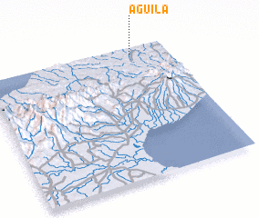 Places with similar names to Aguila, Panama ::
Disclaimer :: Information on this page comes without warranty of any kind |
||
|
Where is Aguila? Elevation and coordinates ::
Latitude (lat): 8°57'9"N Longitude (lon): 80°11'29"W
Elevation (approx.): 29m (map arrows pan, magnifying glasses zoom) |
||
|
Visiting Aguila? Hotel/Accommodation ::
Book a hotel in Aguila Travel Guide ::
Buy a travel guide for Panama rental cars ::
car rental offers GPS waypoint ::
download a GPX waypoint (PoI) of Aguila for your GPS receiver
|
||