|
search place name
|
||
Al Yarmūk (Baghdād, Iraq)Al Yarmūk is a town in the Baghdād region of Iraq. An overview map of the region around Al Yarmūk is displayed below.
regional and 3d topo map of Al Yarmūk, Iraq ::

Nearby towns ::
Madīnat al Maʼmūn (0.7km east) //
Al Ḩārithīyah (1.0km east) //
Ḩayy al Manşūr (1.6km north east) //
Al Ḩamrāʼ (2.3km west) //
Al Jihād (2.8km south) //
Al Khaḑrāʼ (2.9km north west) //
At Taʼmīm (3.6km south) //
Al Washāsh (3.8km north) //
Al Karkh (3.6km east) //
Chalabī (4.2km north west) //
Al Firdaws (4.4km west) //
Aş Şāliḩīyah (4.5km north east) //
Al Jāmi‘ah (4.7km south east) //
Al Jazāʼir (5.4km south east) //
‘Alāwī al Ḩillah (5.5km north east) //
Al Ḩurrīyah (6.3km north) //
Al Karrādah (6.0km east) //
Baghdād (6.6km north east) //
‘Abd al Wāḩid (6.5km south west) //
Bāb ash Shaykh (6.7km north east) //
Sūq al Ghazl (6.7km north east) //
Qāţirkhānah (6.7km north east) //
Sālim (6.8km south east) //
Az Zahrāʼ (7.9km north) //
Ad Dawrah (7.3km south east) //
An Nīl (7.4km north east) //
Al Jazīrah (7.3km south east) //
Al Kāz̧imīyah (8.5km north) //
Al Wazīrīyah (8.0km north east) //
[all distances 'as the bird flies' and approximate] 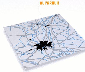 Places with similar names to Al Yarmūk, Iraq ::
// Al Yarmūk (KW)
Disclaimer :: Information on this page comes without warranty of any kind |
||
|
Where is Al Yarmūk? Elevation and coordinates ::
Latitude (lat): 33°18'2"N Longitude (lon): 44°20'21"E
Elevation (approx.): 39m (map arrows pan, magnifying glasses zoom) |
||
|
Visiting Al Yarmūk? Hotel/Accommodation ::
Book a hotel in Al Yarmūk Travel Guide ::
Buy a travel guide for Iraq rental cars ::
car rental offers GPS waypoint ::
download a GPX waypoint (PoI) of Al Yarmūk for your GPS receiver
|
||