|
search place name
|
||
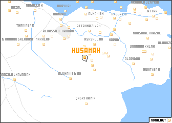
Ḩusāmah (Al Başrah, Iraq)Ḩusāmah is a town in the Al Başrah region of Iraq. An overview map of the region around Ḩusāmah is displayed below.
regional and 3d topo map of Ḩusāmah, Iraq ::
Ḩusāmah airports ::
The nearest airport is BSR - Basrah Intl, located 113.7 km east of Ḩusāmah.
Other airports nearby include ABD - Abadan (171.4 km east), KWI - Kuwait Intl (225.2 km south east), Nearby towns ::
Kuraydī al Ḩusayn (1.2km east) //
Sayyid Bartū (1.5km south east) //
Ālbū Ḩamdān (1.7km north) //
Sayyid Nı‘mah (2.4km south east) //
Abū Ḩamadī ash Shamālīyah (2.7km north) //
Abū Ḩamadī al Janūbīyah (3.3km north) //
Baḩr (3.7km north east) //
Ash Shu‘lah (4.0km north east) //
Al Kurmāshīyah al Gharbīyah (4.3km north east) //
Al Kurmāshīyah ash Sharqīyah (4.3km east) //
Al Khamīsīyah (4.7km south west) //
Ḩakkām (6.4km north west) //
Aţ Ţahmāzīyah (6.7km north) //
‘Awdah (6.4km north west) //
Banī ‘Abd ar Riḑāʼ (6.8km north east) //
Ma‘rūḑ (6.5km north east) //
Āl ‘Akl (7.5km north east) //
Rushūd (8.1km north west) //
Al Başşah (8.5km north west) //
Karmat Banī Sa‘īd (8.8km north east) //
Sūq ash Shuyūkh (9.1km north west) //
[all distances 'as the bird flies' and approximate]  Places with similar names to Ḩusāmah, Iraq ::
Disclaimer :: Information on this page comes without warranty of any kind |
||
|
Where is Ḩusāmah? Elevation and coordinates ::
Latitude (lat): 30°49'0"N Longitude (lon): 46°31'0"E
Elevation (approx.): 1m (map arrows pan, magnifying glasses zoom) |
||
|
Visiting Ḩusāmah? Hotel/Accommodation ::
Book a hotel in Ḩusāmah Travel Guide ::
Buy a travel guide for Iraq rental cars ::
car rental offers GPS waypoint ::
download a GPX waypoint (PoI) of Ḩusāmah for your GPS receiver
|
||