|
search place name
|
||
Ibrāhīm al Kabīr (Şalāḩ ad Dīn, Iraq)Ibrāhīm al Kabīr is a town in the Şalāḩ ad Dīn region of Iraq. An overview map of the region around Ibrāhīm al Kabīr is displayed below.
regional and 3d topo map of Ibrāhīm al Kabīr, Iraq ::

Nearby towns ::
Ibrāhīm aş Şaghīr (1.5km south west) //
Wārānī (2.6km south west) //
Sayyid Garmūk (4.0km north east) //
Zindānah (5.1km south) //
Kūshk (4.3km west) //
Zindānah (4.9km south east) //
Chāūrī (5.3km south west) //
‘Umar Şūfī (6.6km north west) //
Ḩaydar Rasūl (7.2km north) //
Sālī (6.7km south west) //
Bāsh Tappah (7.0km west) //
[all distances 'as the bird flies' and approximate] 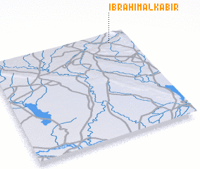 Places with similar names to Ibrāhīm al Kabīr, Iraq :: Disclaimer :: Information on this page comes without warranty of any kind |
||
|
Where is Ibrāhīm al Kabīr? Elevation and coordinates ::
Latitude (lat): 34°55'28"N Longitude (lon): 44°51'49"E
Elevation (approx.): 337m (map arrows pan, magnifying glasses zoom) |
||
|
Visiting Ibrāhīm al Kabīr? Hotel/Accommodation ::
Book a hotel in Ibrāhīm al Kabīr Travel Guide ::
Buy a travel guide for Iraq rental cars ::
car rental offers GPS waypoint ::
download a GPX waypoint (PoI) of Ibrāhīm al Kabīr for your GPS receiver
|
||