|
search place name
|
||
Kānī Balāv (Dahūk, Iraq)Kānī Balāv is a town in the Dahūk region of Iraq. An overview map of the region around Kānī Balāv is displayed below.
regional and 3d topo map of Kānī Balāv, Iraq ::

Kānī Balāv airports ::
The nearest airport is VAN - Van, located 143.8 km north of Kānī Balāv.
Nearby towns ::
Bāpīr (1.3km north) //
Bānkā (2.9km south) //
Garaku (2.6km north west) //
Bābgūrī (3.3km south west) //
Rewān (4.1km north) //
Ārzē (4.4km south) //
Bilōzān (3.6km east) //
Dēhē (4.9km south) //
Chagala Zhēri (5.1km north) //
Hershi (4.1km east) //
Chagala (5.9km north) //
Girga (5.2km north east) //
Wūrmēl (4.8km west) //
Ḩasan Parka (6.5km south) //
Gārku (5.5km north west) //
Birifka (6.4km north east) //
Rewān (6.1km north east) //
Bēgōya (6.7km north) //
Chālgī (6.8km north east) //
Khishkhāsh (6.3km north east) //
Hamzān (7.5km south) //
Chālkī (8.0km north) //
Bāzē (6.5km east) //
Chamsayda (6.9km east) //
Bilīkhān (6.9km west) //
Billijank (8.8km south) //
Agār Zhērī (8.7km north) //
Zēwa Pīrāmūs (8.1km south east) //
Pāsē (7.9km south west) //
[all distances 'as the bird flies' and approximate] 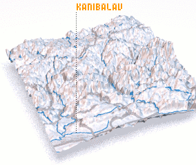 Places with similar names to Kānī Balāv, Iraq ::
// Gonoa Bluff (US)
// Gonobilovo (RU)
Disclaimer :: Information on this page comes without warranty of any kind |
||
|
Where is Kānī Balāv? Elevation and coordinates ::
Latitude (lat): 37°10'41"N Longitude (lon): 43°11'6"E
Elevation (approx.): 1123m (map arrows pan, magnifying glasses zoom) |
||
|
Visiting Kānī Balāv? Hotel/Accommodation ::
Book a hotel in Kānī Balāv Travel Guide ::
Buy a travel guide for Iraq rental cars ::
car rental offers GPS waypoint ::
download a GPX waypoint (PoI) of Kānī Balāv for your GPS receiver
|
||