|
search place name
|
||
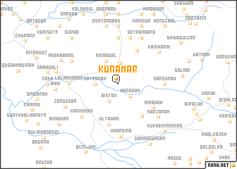
Kunāmār (As Sulaymānīyah, Iraq)Kunāmār is a town in the As Sulaymānīyah region of Iraq. An overview map of the region around Kunāmār is displayed below.
regional and 3d topo map of Kunāmār, Iraq ::
Kunāmār airports ::
The nearest airport is SDG - Sanandaj, located 114.7 km south east of Kunāmār.
Other airports nearby include KSH - Bakhtaran Shahid Ashrafi Esfahani (194.1 km south east), Nearby towns ::
Deza (2.4km north east) //
Barāwah (2.4km south east) //
Bistan (2.9km south west) //
Kāragal (3.4km north) //
Sayrānah (3.0km west) //
Mīr ‘Abdal (4.0km north) //
Aḩmad Āwah (5.8km north east) //
Germak (5.9km south east) //
‘Ulyāwah (6.5km south) //
Mīrāwah (5.8km south east) //
Hameh Khānemīyeh (7.4km north) //
Sar Sūrāw (6.0km east) //
Kūkh Halāleh Ebrāhīm (7.4km north) //
Kūh-e Salīm (7.6km north) //
Kānī Mīrān (7.0km south west) //
Lālā Ḩumrān (6.4km west) //
Narzanah (7.3km south east) //
Kānī Harmī (7.3km north east) //
‘Umar Sina (8.3km south) //
Seyrān Band (8.0km north) //
Mosherau (7.1km north west) //
Zangedar (7.7km south west) //
Sūrāb (9.5km north west) //
Kūkh-e Mīr ‘Os̄mān (9.5km south east) //
[all distances 'as the bird flies' and approximate]  Places with similar names to Kunāmār, Iraq ::
Disclaimer :: Information on this page comes without warranty of any kind |
||
|
Where is Kunāmār? Elevation and coordinates ::
Latitude (lat): 35°46'0"N Longitude (lon): 45°55'0"E
Elevation (approx.): 1214m (map arrows pan, magnifying glasses zoom) |
||
|
Visiting Kunāmār? Hotel/Accommodation ::
Book a hotel in Kunāmār Travel Guide ::
Buy a travel guide for Iraq rental cars ::
car rental offers GPS waypoint ::
download a GPX waypoint (PoI) of Kunāmār for your GPS receiver
|
||