|
search place name
|
||
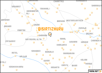
Qisirt-ī Zhūrū (As Sulaymānīyah, Iraq)Qisirt-ī Zhūrū is a town in the As Sulaymānīyah region of Iraq. An overview map of the region around Qisirt-ī Zhūrū is displayed below.
regional and 3d topo map of Qisirt-ī Zhūrū, Iraq ::
Qisirt-ī Zhūrū airports ::
The nearest airport is SDG - Sanandaj, located 132.0 km east of Qisirt-ī Zhūrū.
Other airports nearby include KSH - Bakhtaran Shahid Ashrafi Esfahani (182.9 km south east), Nearby towns ::
Kharāba (2.1km north) //
Gulān (2.4km north) //
Shammah (2.4km west) //
Shaykh Hōmar (2.6km south east) //
Wēlaka-i Zhūrū (3.7km south west) //
Wēlaka-i Khwāru (3.9km south west) //
Kamālān-i Khwārū (4.0km north west) //
Qarālī (4.5km north east) //
Bākhcha (4.0km west) //
Darband-i Faqara (4.9km south) //
Namal (4.3km south east) //
Kāzīr (4.4km west) //
Kamālān-i Zhūrū (4.8km north west) //
Kharjāna (5.3km south east) //
Gadan (5.2km north west) //
Bārīkah (5.5km north east) //
Jōlāna (6.1km south east) //
Mīr Yāsīn al ‘Ulyá (5.6km south west) //
Āwagala (6.7km south) //
Qaragōl-i Khwārū (6.0km east) //
Faqīra-i Tāza (7.1km south) //
Gōmirt (6.9km north west) //
Qaragōl-i Zhūrū (6.6km east) //
Kōra-i Gawra (8.0km south) //
Shīwiqāẕī (7.8km south west) //
Faraj Āwah (8.6km north) //
Balūl (7.6km south east) //
Dē-i Ramaẕān (8.0km north west) //
Qāmīshān (8.7km south) //
[all distances 'as the bird flies' and approximate] 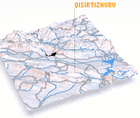 Places with similar names to Qisirt-ī Zhūrū, Iraq :: Disclaimer :: Information on this page comes without warranty of any kind |
||
|
Where is Qisirt-ī Zhūrū? Elevation and coordinates ::
Latitude (lat): 35°20'23"N Longitude (lon): 45°33'44"E
Elevation (approx.): 661m (map arrows pan, magnifying glasses zoom) |
||
|
Visiting Qisirt-ī Zhūrū? Hotel/Accommodation ::
Book a hotel in Qisirt-ī Zhūrū Travel Guide ::
Buy a travel guide for Iraq rental cars ::
car rental offers GPS waypoint ::
download a GPX waypoint (PoI) of Qisirt-ī Zhūrū for your GPS receiver
|
||