|
search place name
|
||
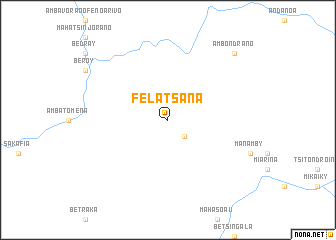
Felatsana (Fianarantsoa, Madagascar)Felatsana is a town in the Fianarantsoa region of Madagascar. An overview map of the region around Felatsana is displayed below.
regional and 3d topo map of Felatsana, Madagascar ::
Felatsana airports ::
The nearest airport is WFI - Fianarantsoa, located 134.3 km east of Felatsana.
Other airports nearby include MOQ - Morondava (190.6 km north west), ZVA - Miandrivazo (191.0 km north), RVA - Farafangana (267.9 km south east), Nearby towns ::
Andangoraikitra (2.5km south east) //
Ambondrano (10.1km north east) //
[all distances 'as the bird flies' and approximate]  Places with similar names to Felatsana, Madagascar ::
// Fletzen (DE)
// Valtsiniá (GR)
// Fălticeni (RO)
// Vlădiceni (RO)
// Vlădiceni (RO)
// Vlăduceni (RO)
// Val de Asón (ES)
// Vila de Sena (MZ)
// Vládyčín (CZ)
// Flatåsen (SE)
Disclaimer :: Information on this page comes without warranty of any kind |
||
|
Where is Felatsana? Elevation and coordinates ::
Latitude (lat): 21°15'0"S Longitude (lon): 45°50'0"E
Elevation (approx.): 610m (map arrows pan, magnifying glasses zoom) |
||
|
Visiting Felatsana? Hotel/Accommodation ::
Book a hotel in Felatsana Travel Guide ::
Buy a travel guide for Madagascar rental cars ::
car rental offers GPS waypoint ::
download a GPX waypoint (PoI) of Felatsana for your GPS receiver
|
||