|
search place name
|
||
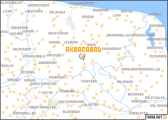
Akbarābād (Gīlān, Iran)Akbarābād is a town in the Gīlān region of Iran. An overview map of the region around Akbarābād is displayed below.
regional and 3d topo map of Akbarābād, Iran ::
Akbarābād airports ::
The nearest airport is RAS - Rasht, located 40.1 km west of Akbarābād.
Other airports nearby include RZR - Ramsar (70.1 km south east), THR - Teheran Mehrabad Intl (211.0 km south east), Nearby towns ::
Qāẕī Maḩalleh-ye Pahmedān (0.7km south) //
Zīr Deh (1.5km north) //
Mīān Maḩalleh-ye Pahmadān (1.6km south) //
Pahmadān-e Bālā Maḩalleh (1.7km south) //
Şedā Poshteh (1.9km south) //
Mehdīābād-e Sheykh ‘Alī Kelāyeh (1.5km east) //
Pahmadān-e Pa'īn Maḩalleh (1.6km south east) //
Sheykh ‘Alī Kelāyeh (1.5km east) //
Kelīd Sar (2.0km north) //
Īshkā' (2.9km north east) //
Emām Dūst Maḩalleh (2.8km south west) //
Şeyqal Sarā (2.6km west) //
Dehshāl (3.0km north west) //
Mota‘aleq Maḩalleh (3.4km south) //
Tāzehābād (3.1km north west) //
Fūshāzdeh (3.6km north) //
Dargāh-e Pā'īn (3.2km north west) //
Ţālesh Maḩalleh-ye Amīr Hendeh-e Dehshāl (3.8km north) //
Şedā Poshteh (3.6km south west) //
Leshkām (3.9km north west) //
Yashūndeh (4.3km north) //
Bīn Kelāyeh (3.6km south east) //
Ra‘īyyat Maḩalleh (4.3km south) //
Pā'īn Maḩalleh-ye Rūdbaneh (4.4km south west) //
Dargāh-e Bālā (3.9km west) //
Bālā Maḩalleh-ye Gīldeh (4.6km north east) //
Kīldeh (4.6km north east) //
Bālā Maḩalleh-ye Amīr Hendeh (5.0km north) //
Lākmeh Sar (4.8km south west) //
[all distances 'as the bird flies' and approximate]  Places with similar names to Akbarābād, Iran ::
Disclaimer :: Information on this page comes without warranty of any kind |
||
|
Where is Akbarābād? Elevation and coordinates ::
Latitude (lat): 37°17'52"N Longitude (lon): 50°3'26"E
Elevation (approx.): -18m (map arrows pan, magnifying glasses zoom) |
||
|
Visiting Akbarābād? Hotel/Accommodation ::
Book a hotel in Akbarābād Travel Guide ::
Buy a travel guide for Iran rental cars ::
car rental offers GPS waypoint ::
download a GPX waypoint (PoI) of Akbarābād for your GPS receiver
|
||