|
search place name
|
||
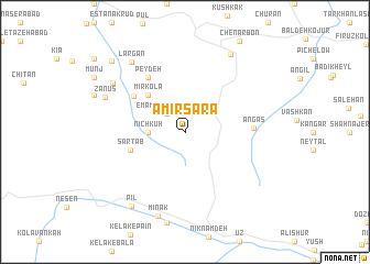
Amīrsarā (Iran)Amīrsarā is a town in Iran. An overview map of the region around Amīrsarā is displayed below.
regional and 3d topo map of Amīrsarā, Iran ::
Amīrsarā airports ::
The nearest airport is THR - Teheran Mehrabad Intl, located 73.1 km south of Amīrsarā.
Other airports nearby include RZR - Ramsar (107.7 km north west), Nearby towns ::
Emāmzādeh Yūsef (2.4km north west) //
Darvīsh Amīr (2.4km north west) //
Nīch Kūh (3.0km west) //
Kandolūs (4.8km north west) //
Mīr Kolā (4.8km north west) //
Sartāb (4.8km west) //
Gīl Kolā-ye Zānūs Rostāq (5.6km north west) //
Pey Deh (6.3km north west) //
Angās (5.6km east) //
Zānūs (7.4km north west) //
Khūshal (7.7km north west) //
Mīnāk (8.8km south) //
Largān (8.3km north west) //
Lāshak (8.7km north east) //
Pīl (8.7km south west) //
Gīl Kolā-ye Zānūs Rostāq-e Kojūr (9.4km north west) //
[all distances 'as the bird flies' and approximate]  Places with similar names to Amīrsarā, Iran ::
Disclaimer :: Information on this page comes without warranty of any kind |
||
|
Where is Amīrsarā? Elevation and coordinates ::
Latitude (lat): 36°18'0"N Longitude (lon): 51°37'0"E
Elevation (approx.): 2583m (map arrows pan, magnifying glasses zoom) |
||
|
Visiting Amīrsarā? Hotel/Accommodation ::
Book a hotel in Amīrsarā Travel Guide ::
Buy a travel guide for Iran rental cars ::
car rental offers GPS waypoint ::
download a GPX waypoint (PoI) of Amīrsarā for your GPS receiver
|
||