|
search place name
|
||
Anjīdān (Khorāsān, Iran)Anjīdān is a town in the Khorāsān region of Iran. An overview map of the region around Anjīdān is displayed below.
regional and 3d topo map of Anjīdān, Iran ::

Anjīdān airports ::
The nearest airport is ASB - Ashkhabad Ashgabat, located 204.1 km north of Anjīdān.
Nearby towns ::
Faraḩābād (0.5km north east) //
Mehrābād (0.6km west) //
Shād Mehrak (1.2km south) //
Chambarān (2.3km north) //
Şāleḩābād (2.3km north east) //
Kafkadak (2.0km north east) //
Raḩmatābād (2.7km north) //
Raḩīmābād (2.7km north) //
Ḩoseynābād-e Salāmī (2.7km north) //
Qabed (2.4km east) //
Ardesmān (3.0km north) //
Helālī (2.9km north west) //
Loţfābād (2.5km west) //
Deh Now (2.9km north west) //
Zargarān (2.8km east) //
Kārjīj (3.3km south east) //
Masīḩābād (3.3km south west) //
Bolqosheh (3.4km south) //
Ārezūmandeh (3.0km west) //
Ḩakīmābād (3.0km west) //
Moḩīţābād (3.0km west) //
Hāshemābād (4.2km south) //
Moz̧affarābād (3.8km north west) //
Ābjeqān (3.8km north west) //
Eslāmīyeh (4.4km south) //
Karīmābād (4.5km north) //
Ḩanţābād (4.5km south) //
Şāleḩī (4.5km north) //
Shahrak (4.5km north) //
[all distances 'as the bird flies' and approximate] 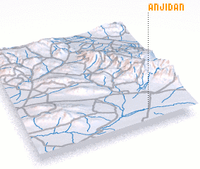 Places with similar names to Anjīdān, Iran ::
Disclaimer :: Information on this page comes without warranty of any kind |
||
|
Where is Anjīdān? Elevation and coordinates ::
Latitude (lat): 36°10'34"N Longitude (lon): 58°45'51"E
Elevation (approx.): 1156m (map arrows pan, magnifying glasses zoom) |
||
|
Visiting Anjīdān? Hotel/Accommodation ::
Book a hotel in Anjīdān Travel Guide ::
Buy a travel guide for Iran rental cars ::
car rental offers GPS waypoint ::
download a GPX waypoint (PoI) of Anjīdān for your GPS receiver
|
||