|
search place name
|
||
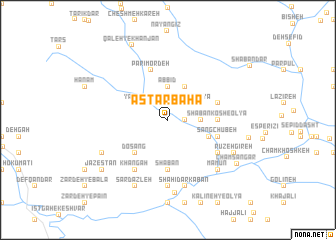
Astarbahā (Lorestān, Iran)Astarbahā is a town in the Lorestān region of Iran. An overview map of the region around Astarbahā is displayed below.
regional and 3d topo map of Astarbahā, Iran ::
Astarbahā airports ::
The nearest airport is QMJ - Masjed Soleiman Shahid Asyaee, located 145.0 km south of Astarbahā.
Other airports nearby include KSH - Bakhtaran Shahid Ashrafi Esfahani (192.2 km north west), AWZ - Ahwaz (210.2 km south), Nearby towns ::
Şeyd-e Nar (1.6km east) //
Posht-e Koreh (1.6km east) //
‘Alīābād (2.4km north west) //
Khīārshūr-e ‘Olyā (2.4km north east) //
Chenār Shūr-e ‘Olyā (3.1km east) //
Chenār Shūr-e Soflá (3.1km east) //
Golsīr (3.1km east) //
Āb Bīd (3.7km north) //
Najaft (3.6km north west) //
Yāsūr (3.6km north west) //
Zangūl Dar (4.0km north east) //
Now Deh (4.3km south east) //
Do Sang (4.8km south west) //
Ālīr (4.8km south west) //
Sha‘bān (5.6km south) //
Shabānkosh-e ‘Olyā (4.7km east) //
Shabānkosh-e Soflá (4.7km east) //
Kūleh Khar-e ‘Olyā (5.6km south) //
Darreh-ye Eshkaft (5.0km east) //
Chel Rīz (5.0km east) //
Kolvī (5.0km east) //
Sang Chūbeh (5.0km east) //
Bonvār-e Ya‘qūb (5.0km east) //
Berenjī (5.0km east) //
Parī Mordeh (5.8km north) //
Eshgoft (5.9km south east) //
Cholrīz (5.9km south east) //
Khāngāh (6.4km south west) //
Gowdeh-ye Yūk (7.4km south) //
[all distances 'as the bird flies' and approximate] 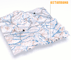 Places with similar names to Astarbahā, Iran :: Disclaimer :: Information on this page comes without warranty of any kind |
||
|
Where is Astarbahā? Elevation and coordinates ::
Latitude (lat): 33°14'0"N Longitude (lon): 48°45'0"E
Elevation (approx.): 1351m (map arrows pan, magnifying glasses zoom) |
||
|
Visiting Astarbahā? Hotel/Accommodation ::
Book a hotel in Astarbahā Travel Guide ::
Buy a travel guide for Iran rental cars ::
car rental offers GPS waypoint ::
download a GPX waypoint (PoI) of Astarbahā for your GPS receiver
|
||