|
search place name
|
||
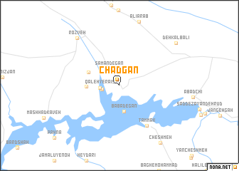
Chādgān (Eşfahān, Iran)Chādgān is a town in the Eşfahān region of Iran. An overview map of the region around Chādgān is displayed below.
regional and 3d topo map of Chādgān, Iran ::
Chādgān airports ::
The nearest airport is QMJ - Masjed Soleiman Shahid Asyaee, located 153.4 km south west of Chādgān.
Other airports nearby include AWZ - Ahwaz (237.2 km south west), Nearby towns ::
Menderjān (2.4km west) //
Qal‘eh-ye Raʼīs (2.6km west) //
Samandegān (3.0km north west) //
Bābādegān (4.1km south) //
Manşūrīyeh (4.4km west) //
Lāpeleh (4.6km north west) //
Tammak (7.3km south east) //
Rozveh (9.2km north west) //
Deh Kalb‘alī (9.9km north east) //
[all distances 'as the bird flies' and approximate]  Places with similar names to Chādgān, Iran ::
// Chodków Nowy (PL)
// Shtiqën (AL)
// Chiţcani (RO)
// Chiţcani (RO)
// Chitkan (RU)
// Shaytakān (IQ)
// Chah Dogāneh (IR)
// Chauddakāni (BD)
// Chitocán (GT)
// Chitucán (GT)
Disclaimer :: Information on this page comes without warranty of any kind |
||
|
Where is Chādgān? Elevation and coordinates ::
Latitude (lat): 32°46'12"N Longitude (lon): 50°37'38"E
Elevation (approx.): 2122m (map arrows pan, magnifying glasses zoom) |
||
|
Visiting Chādgān? Hotel/Accommodation ::
Book a hotel in Chādgān Travel Guide ::
Buy a travel guide for Iran rental cars ::
car rental offers GPS waypoint ::
download a GPX waypoint (PoI) of Chādgān for your GPS receiver
|
||