|
search place name
|
||
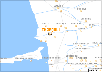
Chārqolī (Golestān, Iran)Chārqolī is a town in the Golestān region of Iran. An overview map of the region around Chārqolī is displayed below.
regional and 3d topo map of Chārqolī, Iran ::
Nearby towns ::
Tūmāchlar-e Chārqolī (0.9km north) //
Dahaneh-ye Yek (1.2km north) //
Dahaneh-ye Do (1.3km east) //
Tūmāchlar (1.4km south west) //
Sa‘īdābād (2.4km south west) //
Chāpāqlī (2.4km south west) //
Şeydgāh-e Khvājeh Nafas (3.5km south west) //
Ganklīk (4.0km north) //
Gowkcheh (4.7km north east) //
Khvājeh Nafas (5.0km east) //
Qareh Kīleh (5.3km north east) //
Bandar-e Torkaman (9.9km south east) //
Ūrkat Ḩājjī (10.3km south east) //
[all distances 'as the bird flies' and approximate]  Places with similar names to Chārqolī, Iran ::
// Shyrokyy Luh (UA)
// Charkli (RU)
// Charīklū (IR)
// Charāikol (BD)
// Chāraikola (BD)
// Char Goāli (BD)
// Char Kāli (BD)
// Char Kāli (BD)
// Churigualla (CL)
// Chircal (CO)
Disclaimer :: Information on this page comes without warranty of any kind |
||
|
Where is Chārqolī? Elevation and coordinates ::
Latitude (lat): 36°59'0"N Longitude (lon): 54°3'0"E
Elevation (approx.): -27m (map arrows pan, magnifying glasses zoom) |
||
|
Visiting Chārqolī? Hotel/Accommodation ::
Book a hotel in Chārqolī Travel Guide ::
Buy a travel guide for Iran rental cars ::
car rental offers GPS waypoint ::
download a GPX waypoint (PoI) of Chārqolī for your GPS receiver
|
||