|
search place name
|
||
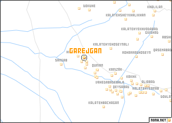
Gārejgān (Khorāsān, Iran)Gārejgān is a town in the Khorāsān region of Iran. An overview map of the region around Gārejgān is displayed below.
regional and 3d topo map of Gārejgān, Iran ::
Gārejgān airports ::
The nearest airport is XBJ - Birjand, located 42.9 km north east of Gārejgān.
Nearby towns ::
Kalāteh-ye ‘Alīābād (0.1km south east) //
Shārfūn (0.7km south) //
Deh Mīr (0.8km west) //
Moḩsenābād-e Āshūrī (1.4km south) //
Kalāteh-ye Rajab (1.4km south) //
Ḩājjī Ākhvond (1.9km north west) //
Kalāteh-ye Moḩammad Gholām (2.7km south east) //
Qūrīān (2.8km south east) //
Mīrzā Aşghar (3.0km south east) //
Pey Rūd (3.7km south east) //
Kalāteh-ye Mīrzā (4.0km south east) //
Moḩammadābād (4.0km south east) //
Vaḩdābād (4.0km south east) //
Sang Āb (4.6km west) //
Kalāteh-ye Ḩoseyn ‘Alī (5.4km north east) //
Māzhān (5.6km south east) //
Kārīzak (6.0km south east) //
Vāḩedābād-e Bālā (7.0km south east) //
Raẕīābād (7.2km south east) //
Akbarābād-e Pā'īn (7.7km south east) //
Golownd (7.5km south east) //
Akbarābād Bālā (8.2km south east) //
Shāh Maḩmūd-e Bālā (8.4km south east) //
Kūsheh (9.0km south east) //
Shāh Maḩmūd-e Pā'īn (9.1km south east) //
Qeyşābād (9.2km south east) //
Shāhābād (10.2km south east) //
[all distances 'as the bird flies' and approximate] 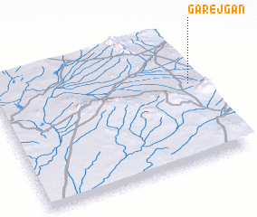 Places with similar names to Gārejgān, Iran ::
Disclaimer :: Information on this page comes without warranty of any kind |
||
|
Where is Gārejgān? Elevation and coordinates ::
Latitude (lat): 32°36'21"N Longitude (lon): 58°57'56"E
Elevation (approx.): 1403m (map arrows pan, magnifying glasses zoom) |
||
|
Visiting Gārejgān? Hotel/Accommodation ::
Book a hotel in Gārejgān Travel Guide ::
Buy a travel guide for Iran rental cars ::
car rental offers GPS waypoint ::
download a GPX waypoint (PoI) of Gārejgān for your GPS receiver
|
||