|
search place name
|
||
Gāv Savār (Īlām, Iran)Gāv Savār is a town in the Īlām region of Iran. An overview map of the region around Gāv Savār is displayed below.
regional and 3d topo map of Gāv Savār, Iran ::

Gāv Savār airports ::
The nearest airport is KSH - Bakhtaran Shahid Ashrafi Esfahani, located 98.6 km north east of Gāv Savār.
Other airports nearby include SDG - Sanandaj (171.4 km north), Nearby towns ::
Eyvān (1.5km north) //
Shīrah Choqā (1.5km west) //
Rīnjūb (1.9km south) //
Dārāb (1.5km east) //
Jūsheh (2.4km north west) //
Māzhīn-e Soflá (3.1km west) //
Māzhīn-e ‘Olyā (3.1km west) //
Dobīrān (3.7km north) //
Choqā Māhī (4.0km north west) //
Chālānchī (3.6km south east) //
Farzaqeh (4.0km south east) //
Palangerd (4.8km north west) //
‘Alīgah (4.8km north west) //
Kharābānān-e Soflá (4.8km south east) //
Kol Kol (4.8km south east) //
Kharānī (4.6km west) //
Do Bīrān-e Soflá (5.6km north) //
Khūrān-e Soflá (5.0km west) //
Hāb (5.0km west) //
Nargesī (5.0km west) //
Khūrān-e ‘Olyā (5.1km west) //
Nazeh (5.9km north west) //
Esmā'īlī-ye Soflá (6.4km north west) //
Jūb-e Shahr Esma‘īl (6.4km north west) //
Shahrak-e Nabovvat (6.4km north west) //
Esmā'īlī-ye ‘Olyā (6.4km north west) //
Kharābānān-e ‘Olyā (5.9km south east) //
Koleh Jūb (6.3km north west) //
Vanīt-e ‘Olyā (6.4km west) //
[all distances 'as the bird flies' and approximate] 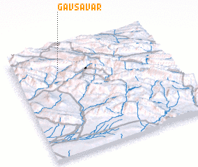 Places with similar names to Gāv Savār, Iran ::
// Gāv Savār (IR)
Disclaimer :: Information on this page comes without warranty of any kind |
||
|
Where is Gāv Savār? Elevation and coordinates ::
Latitude (lat): 33°49'0"N Longitude (lon): 46°18'0"E
Elevation (approx.): 1164m (map arrows pan, magnifying glasses zoom) |
||
|
Visiting Gāv Savār? Hotel/Accommodation ::
Book a hotel in Gāv Savār Travel Guide ::
Buy a travel guide for Iran rental cars ::
car rental offers GPS waypoint ::
download a GPX waypoint (PoI) of Gāv Savār for your GPS receiver
|
||