|
search place name
|
||
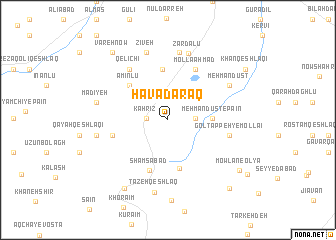
Havā Daraq (Ostān-e Āz̄arbāyjān-e Gharbī, Iran)Havā Daraq is a town in the Ostān-e Āz̄arbāyjān-e Gharbī region of Iran. An overview map of the region around Havā Daraq is displayed below.
regional and 3d topo map of Havā Daraq, Iran ::
Havā Daraq airports ::
The nearest airport is RAS - Rasht, located 142.4 km south east of Havā Daraq.
Nearby towns ::
Kahrīz (1.9km west) //
Chanz̄āb (1.9km west) //
Mehmāndūst-e Bālā (2.5km east) //
Mehmāndūst-e Pā'īn (3.9km east) //
Būsjīn (5.5km south) //
Āq Gūnī (5.7km north) //
Amīnlū (5.1km north west) //
Shamsābād (5.9km south) //
Īncheh (5.1km west) //
Mollā Aḩmad (6.2km north east) //
Gol Tappeh-ye Mollā'ī (5.6km east) //
Qelīchī (6.6km north west) //
Āq Daraq (7.6km north) //
Zardālū (7.6km north) //
Mehmāndūst (6.6km north east) //
Qelīmp (7.8km north) //
Zīveh (7.8km north) //
Kalash-e Kūchek (6.5km west) //
Tāzeh Qeshlāq (8.1km south) //
Mādīyeh (6.6km west) //
Ḩājjī Maḩmūd (8.6km south west) //
Vareh Now (9.0km north west) //
Mowlān-e ‘Olyā (8.4km south east) //
Vāybāsh (9.4km south east) //
Khān Qeshlāqī (8.9km north east) //
Mowlān-e Soflá (9.3km south east) //
[all distances 'as the bird flies' and approximate]  Places with similar names to Havā Daraq, Iran :: Disclaimer :: Information on this page comes without warranty of any kind |
||
|
Where is Havā Daraq? Elevation and coordinates ::
Latitude (lat): 38°2'56"N Longitude (lon): 48°16'19"E
Elevation (approx.): 1480m (map arrows pan, magnifying glasses zoom) |
||
|
Visiting Havā Daraq? Hotel/Accommodation ::
Book a hotel in Havā Daraq Travel Guide ::
Buy a travel guide for Iran rental cars ::
car rental offers GPS waypoint ::
download a GPX waypoint (PoI) of Havā Daraq for your GPS receiver
|
||