|
search place name
|
||
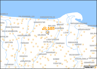
Jīldān (Gīlān, Iran)Jīldān is a town in the Gīlān region of Iran. An overview map of the region around Jīldān is displayed below.
regional and 3d topo map of Jīldān, Iran ::
Jīldān airports ::
The nearest airport is RAS - Rasht, located 22.2 km west of Jīldān.
Other airports nearby include RZR - Ramsar (91.5 km south east), THR - Teheran Mehrabad Intl (230.1 km south east), Nearby towns ::
Jūr Sar (1.0km south east) //
Azhdehā Kīā (1.2km south west) //
Chapak-e Nāz̧emī (1.9km south west) //
Nūdeh (2.1km north west) //
Azhdehā Balūch (2.6km north) //
Āmīldān (2.7km north east) //
Gol Bāzo (2.3km south west) //
Nowsel (2.4km south east) //
Shīsheh Gūrāb (2.4km west) //
Dūbāj (2.5km south west) //
Chepak-e Shafī‘ Maḩalleh (2.7km south west) //
Lasht-e Neshā' (3.1km south east) //
Shahmīr Sarā (3.3km north) //
Esţalak (3.7km south) //
‘Alībozāyeh (3.9km south) //
Deh Sar (4.0km south east) //
Fakhrābād (3.5km north east) //
Mīān Gafsheh (4.6km south) //
Tūchāh-e Ālmān (4.6km south) //
Jūrkūyeh (3.9km west) //
Khoshk-e Rūd (3.9km east) //
Shahrestān (4.7km north west) //
Baleskeleh (4.2km west) //
Chālkosh (4.4km north east) //
Bandar (4.7km north east) //
Ḩājjī Bozāyeh (5.2km south) //
Sheykhān Gafsheh (5.5km south) //
Pas Bījār Gafsheh (5.3km south) //
Gīlovā Maḩalleh (5.0km north west) //
[all distances 'as the bird flies' and approximate]  Places with similar names to Jīldān, Iran ::
Disclaimer :: Information on this page comes without warranty of any kind |
||
|
Where is Jīldān? Elevation and coordinates ::
Latitude (lat): 37°23'24"N Longitude (lon): 49°50'34"E
Elevation (approx.): -19m (map arrows pan, magnifying glasses zoom) |
||
|
Visiting Jīldān? Hotel/Accommodation ::
Book a hotel in Jīldān Travel Guide ::
Buy a travel guide for Iran rental cars ::
car rental offers GPS waypoint ::
download a GPX waypoint (PoI) of Jīldān for your GPS receiver
|
||