|
search place name
|
||
Kāz̧emābād (Kordestān, Iran)Kāz̧emābād is a town in the Kordestān region of Iran. An overview map of the region around Kāz̧emābād is displayed below.
regional and 3d topo map of Kāz̧emābād, Iran ::

Kāz̧emābād airports ::
The nearest airport is SDG - Sanandaj, located 50.8 km west of Kāz̧emābād.
Other airports nearby include KSH - Bakhtaran Shahid Ashrafi Esfahani (105.3 km south), Nearby towns ::
Kameshgarān (2.4km south east) //
Tāzehābād-e Sarāb-e Qaḩţ (3.7km south) //
Sarāb-e Qaḩţ (3.7km south) //
Shojā‘ābād (3.7km north) //
Maḩmūdābād (4.0km south) //
Kānī Ganjī (3.5km south east) //
Kānī Chāy (4.8km north east) //
Chamqolū (4.5km east) //
Shahābīyeh (4.5km east) //
Ţahmāsb Qolī (6.3km west) //
Tāzehābād-e Khalīlābād (7.2km south east) //
Tāzehābād Shahābīyeh (7.2km north east) //
Yālqūz Āghāj (8.0km north) //
‘Abbās Jūb (7.1km north west) //
Qāmlū (7.9km south west) //
Āb Bārīk (8.2km south west) //
Ārazand (8.9km north west) //
Khoshkemrūd-e ‘Olyā (9.6km north east) //
Naşerābād (9.6km north west) //
[all distances 'as the bird flies' and approximate] 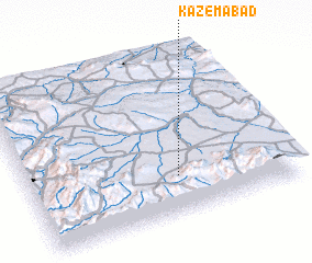 Places with similar names to Kāz̧emābād, Iran ::
// Kazımabad (AZ)
// Kāsimābād (IN)
// Kāz̧emābād (IR)
// Kāz̧emābād (IR)
// Kāz̧emābād (IR)
// Kāz̧emābād (IR)
// Kāz̧emābād (IR)
// Kāz̧emābād (IR)
// Kāz̧emābād (IR)
// Kāz̧emābād (IR)
Disclaimer :: Information on this page comes without warranty of any kind |
||
|
Where is Kāz̧emābād? Elevation and coordinates ::
Latitude (lat): 35°14'0"N Longitude (lon): 47°34'0"E
Elevation (approx.): 1836m (map arrows pan, magnifying glasses zoom) |
||
|
Visiting Kāz̧emābād? Hotel/Accommodation ::
Book a hotel in Kāz̧emābād Travel Guide ::
Buy a travel guide for Iran rental cars ::
car rental offers GPS waypoint ::
download a GPX waypoint (PoI) of Kāz̧emābād for your GPS receiver
|
||