|
search place name
|
||
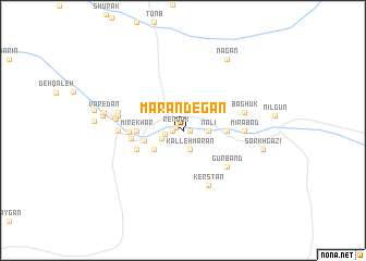
Mārandegān (Sīstān va Balūchestān, Iran)Mārandegān is a town in the Sīstān va Balūchestān region of Iran. An overview map of the region around Mārandegān is displayed below.
regional and 3d topo map of Mārandegān, Iran ::
Mārandegān airports ::
The nearest airport is ZAH - Zahedan Intl, located 212.0 km north of Mārandegān.
Other airports nearby include TRB - Turbo Turbat Intl (262.8 km south east), Nearby towns ::
Rendak (0.7km north west) //
Sham Gat (0.7km east) //
Dūmbīkā (1.0km west) //
Dowmbīkā (1.7km west) //
Kalleh Mārān (2.0km south) //
Zīrkeyk (2.2km south west) //
Dārenā (2.3km east) //
Nālī (2.3km east) //
Bī Bah (2.3km east) //
Kamnīk (3.2km south west) //
Podān (3.7km west) //
Gūr Band (4.0km east) //
Gomn (4.0km east) //
Maḩmūdābād-e Sargūr (4.0km east) //
Mīr-e Khar (4.2km west) //
Hedgān (4.2km west) //
Kūh-e Pāsān (4.7km south west) //
Hītkar-e Bālā (4.7km south west) //
Hītkar-e Pā'īn (4.7km south west) //
Shāvātk (4.7km south west) //
Genzerīk (4.7km south west) //
Dārsān (4.7km south west) //
Dahānā (4.7km west) //
Deh-e Kalāt (4.9km west) //
Gūrband (5.5km south east) //
Kerstān (6.1km south east) //
Mīrābād (5.6km east) //
Bāghūk (5.9km east) //
Kūh-e Nūrk (5.9km west) //
[all distances 'as the bird flies' and approximate] 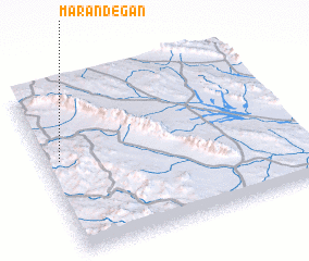 Places with similar names to Mārandegān, Iran :: Disclaimer :: Information on this page comes without warranty of any kind |
||
|
Where is Mārandegān? Elevation and coordinates ::
Latitude (lat): 27°34'2"N Longitude (lon): 61°3'35"E
Elevation (approx.): 1212m (map arrows pan, magnifying glasses zoom) |
||
|
Visiting Mārandegān? Hotel/Accommodation ::
Book a hotel in Mārandegān Travel Guide ::
Buy a travel guide for Iran rental cars ::
car rental offers GPS waypoint ::
download a GPX waypoint (PoI) of Mārandegān for your GPS receiver
|
||