|
search place name
|
||
Nārestān (Khorāsān, Iran)Nārestān is a town in the Khorāsān region of Iran. An overview map of the region around Nārestān is displayed below.
regional and 3d topo map of Nārestān, Iran ::
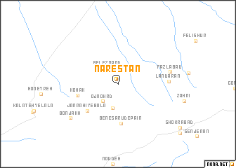
Nearby towns ::
Belezqand (2.7km north west) //
Ojnowrd (3.5km south west) //
Homā'ī (3.9km south) //
Benesarūd-e Pā'īn (6.3km south) //
Jarrāḩī-ye Bālā (5.8km south west) //
Kohak (5.5km west) //
Landarān (6.6km east) //
Faẕlābād (6.9km east) //
Bonjakh (8.1km south west) //
[all distances 'as the bird flies' and approximate]  Places with similar names to Nārestān, Iran ::
// Norristown (US)
// Norristown (US)
// Norristown (US)
// Norristown (US)
// Nārastān (IN)
// Nārestān (IR)
// Nārestān (IR)
// Nārestāneh (IR)
// Nahr-e Sa‘dūnī (IR)
// Nor Zeytʼun (AM)
Disclaimer :: Information on this page comes without warranty of any kind |
||
|
Where is Nārestān? Elevation and coordinates ::
Latitude (lat): 35°48'16"N Longitude (lon): 57°15'39"E
Elevation (approx.): 1342m (map arrows pan, magnifying glasses zoom) |
||
|
Visiting Nārestān? Hotel/Accommodation ::
Book a hotel in Nārestān Travel Guide ::
Buy a travel guide for Iran rental cars ::
car rental offers GPS waypoint ::
download a GPX waypoint (PoI) of Nārestān for your GPS receiver
|
||