|
search place name
|
||
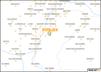
Pīrajeh (Iran)Pīrajeh is a town in Iran. An overview map of the region around Pīrajeh is displayed below.
regional and 3d topo map of Pīrajeh, Iran ::
Pīrajeh airports ::
The nearest airport is THR - Teheran Mehrabad Intl, located 75.2 km south of Pīrajeh.
Other airports nearby include RZR - Ramsar (81.9 km north west), RAS - Rasht (184.8 km north west), Nearby towns ::
Velasht (1.9km north) //
‘Asal Sar (1.5km west) //
Kenes Darreh (1.5km west) //
Mejel (2.4km north west) //
Āshīr (2.4km north east) //
Panjak (2.7km north) //
Mījlār (2.6km north west) //
Seyyed Khāneh Sar (3.0km west) //
Pūstīnābād (3.7km north) //
Lārak (3.5km south west) //
Karīmābād (4.0km north) //
Ţowvīr (4.4km north west) //
Akhtar (4.8km north west) //
Dehnār (4.8km north west) //
Chāl Zamīn (4.8km north west) //
Kūtīr (4.5km west) //
Meres (4.5km west) //
Kalposht (5.6km north) //
Harsh (4.8km north west) //
Makā Rūd (4.8km west) //
Eshkārlet (5.8km north) //
Makār (5.3km west) //
Halī Hasht (5.8km north west) //
Polowshan (5.8km south west) //
Fīrūzābād (5.9km east) //
Razān (7.4km north) //
Māsāl (7.6km north) //
Bābū Deh (7.6km north) //
Bondar-e Soflá (7.7km north) //
[all distances 'as the bird flies' and approximate]  Places with similar names to Pīrajeh, Iran ::
Disclaimer :: Information on this page comes without warranty of any kind |
||
|
Where is Pīrajeh? Elevation and coordinates ::
Latitude (lat): 36°22'0"N Longitude (lon): 51°18'0"E
Elevation (approx.): 1167m (map arrows pan, magnifying glasses zoom) |
||
|
Visiting Pīrajeh? Hotel/Accommodation ::
Book a hotel in Pīrajeh Travel Guide ::
Buy a travel guide for Iran rental cars ::
car rental offers GPS waypoint ::
download a GPX waypoint (PoI) of Pīrajeh for your GPS receiver
|
||