|
search place name
|
||
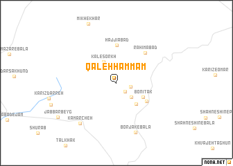
Qal‘eh Ḩammām (Khorāsān, Iran)Qal‘eh Ḩammām is a town in the Khorāsān region of Iran. An overview map of the region around Qal‘eh Ḩammām is displayed below.
regional and 3d topo map of Qal‘eh Ḩammām, Iran ::
Qal‘eh Ḩammām airports ::
The nearest airport is HEA - Herat, located 207.4 km south east of Qal‘eh Ḩammām.
Nearby towns ::
Naqd‘alī-ye Bālā (1.8km south east) //
Naqd‘alī-ye Pāʼīn (1.9km east) //
Borjak-e Naqd ‘Alī (3.0km south east) //
Kāl-e Sorkh (3.8km north west) //
Borjak-e Pā'īn (4.3km south east) //
Bonī Tāk (4.2km south east) //
Banī Tāk (4.9km south east) //
Ḩājjīābād (6.1km north) //
Raḩīmābād (6.2km north east) //
Borjak-e Bālā (8.4km south) //
Kamarcheh (8.1km south west) //
[all distances 'as the bird flies' and approximate] 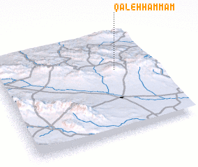 Places with similar names to Qal‘eh Ḩammām, Iran ::
// KuLombombo (ZA)
// Kīlmama (ET)
// Kelimamoa (MG)
// Kalumbami (CD)
// Kilimbimu (CD)
// Kolomboma (CD)
// Galoumboma (CG)
// Gol Mīm (IR)
// Gul Imām (PK)
// Qal‘eh Ḩammām (IR)
Disclaimer :: Information on this page comes without warranty of any kind |
||
|
Where is Qal‘eh Ḩammām? Elevation and coordinates ::
Latitude (lat): 35°38'14"N Longitude (lon): 60°45'42"E
Elevation (approx.): 1213m (map arrows pan, magnifying glasses zoom) |
||
|
Visiting Qal‘eh Ḩammām? Hotel/Accommodation ::
Book a hotel in Qal‘eh Ḩammām Travel Guide ::
Buy a travel guide for Iran rental cars ::
car rental offers GPS waypoint ::
download a GPX waypoint (PoI) of Qal‘eh Ḩammām for your GPS receiver
|
||