|
search place name
|
||
Qīn Sakht (Ostān-e Kermānshāh, Iran)Qīn Sakht is a town in the Ostān-e Kermānshāh region of Iran. An overview map of the region around Qīn Sakht is displayed below.
regional and 3d topo map of Qīn Sakht, Iran ::

Qīn Sakht airports ::
The nearest airport is SDG - Sanandaj, located 96.7 km east of Qīn Sakht.
Other airports nearby include KSH - Bakhtaran Shahid Ashrafi Esfahani (132.6 km south east), Nearby towns ::
Karseh (1.7km south east) //
Dārehrash (1.7km north west) //
Shīrvaleh (1.7km north west) //
Darvaleh-ye Bālā (1.7km north west) //
Kūseh (2.4km south) //
Īmān (2.6km south west) //
Darlūeh (2.6km north west) //
Kolūr (2.8km north west) //
Dagāgā (3.4km north) //
Jīvar (3.6km south west) //
Paseh Khūr (3.7km south east) //
Dagāgāh (3.7km north east) //
Darvaleh-ye Pā'īn (4.1km north west) //
Sīmān (4.1km east) //
Darreh Yāb (5.5km south east) //
Mordin (5.8km north east) //
Bānī Nār (5.4km south west) //
Gazneh (5.8km west) //
‘Alīkhānī (7.1km south) //
Chinār (6.6km north east) //
Kānī Sālār (6.8km north west) //
Kaleh (6.5km north west) //
Gūrīgūr (6.5km east) //
Bāral (6.8km east) //
Lāwrān (7.4km north west) //
Nayjālah (7.2km east) //
Sowteh (8.6km south) //
Banāvach (8.7km south) //
Sīānāb-e Pārāb (8.7km south east) //
[all distances 'as the bird flies' and approximate] 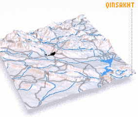 Places with similar names to Qīn Sakht, Iran ::
// Cansuaguit (PH)
// Kānī Sakht (IQ)
// Güneysöğüt (TR)
// Canzacoto (EC)
// Kanī Sakht (IR)
// Kansigada (GN)
// K'unsegot (KP)
// Kanaskat (US)
// Känskit (FI)
// Kinschot (BE)
Disclaimer :: Information on this page comes without warranty of any kind |
||
|
Where is Qīn Sakht? Elevation and coordinates ::
Latitude (lat): 35°2'17"N Longitude (lon): 45°58'44"E
Elevation (approx.): 544m (map arrows pan, magnifying glasses zoom) |
||
|
Visiting Qīn Sakht? Hotel/Accommodation ::
Book a hotel in Qīn Sakht Travel Guide ::
Buy a travel guide for Iran rental cars ::
car rental offers GPS waypoint ::
download a GPX waypoint (PoI) of Qīn Sakht for your GPS receiver
|
||