|
search place name
|
||
Salmangūn (Iran)Salmangūn is a town in Iran. An overview map of the region around Salmangūn is displayed below.
regional and 3d topo map of Salmangūn, Iran ::

Salmangūn airports ::
The nearest airport is XBJ - Birjand, located 62.0 km north west of Salmangūn.
Nearby towns ::
Kalāteh-ye Moḩammadī (0.3km north west) //
‘Alīābād (1.6km west) //
Gūsīan (1.9km north) //
Jannatābād (1.9km south) //
Kalāteh-ye Jadīn (1.9km south) //
Qodsīān (2.2km north) //
Kalāteh-ye Sheykh (3.7km north) //
Homand (4.0km north west) //
Golandar (4.5km south east) //
Qūlang-e Shū Now (4.2km west) //
Rokn od Dīn (4.9km south west) //
Valang Shūrūd (4.7km west) //
Kalāteh Jīkī (4.7km west) //
Bīmorz (5.0km west) //
Kelīdābād (5.5km north west) //
Ākhūndān (5.5km north west) //
Shaftālestān (5.5km north west) //
Kalāteh-ye Ākhūnd (5.5km north west) //
Cheshmeh Kūshk (6.0km south east) //
Mollā Ebrāhīm (6.0km north west) //
Neyk (6.2km east) //
Dowlatābād (6.5km west) //
Nūqhāb (7.6km south east) //
Kabūdeh (8.3km north west) //
Kalāteh-ye Mīr Qāzī (8.8km north west) //
[all distances 'as the bird flies' and approximate] 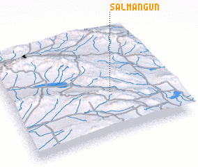 Places with similar names to Salmangūn, Iran ::
// Selemiangan (ID)
// Salimbangan (PH)
Disclaimer :: Information on this page comes without warranty of any kind |
||
|
Where is Salmangūn? Elevation and coordinates ::
Latitude (lat): 32°26'0"N Longitude (lon): 59°38'0"E
Elevation (approx.): 2008m (map arrows pan, magnifying glasses zoom) |
||
|
Visiting Salmangūn? Hotel/Accommodation ::
Book a hotel in Salmangūn Travel Guide ::
Buy a travel guide for Iran rental cars ::
car rental offers GPS waypoint ::
download a GPX waypoint (PoI) of Salmangūn for your GPS receiver
|
||