|
search place name
|
||
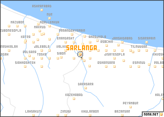
Sarlangā (Iran)Sarlangā is a town in Iran. An overview map of the region around Sarlangā is displayed below.
regional and 3d topo map of Sarlangā, Iran ::
Sarlangā airports ::
The nearest airport is RZR - Ramsar, located 45.2 km north west of Sarlangā.
Other airports nearby include THR - Teheran Mehrabad Intl (112.0 km south), RAS - Rasht (150.9 km north west), Nearby towns ::
Bandbon (0.0km north) //
Hardo Āb Rūd (0.0km north) //
Mashāollāhābād (0.7km south east) //
‘Alīābād (1.5km east) //
Kāz̧em Kolā (1.9km north) //
Parchehvar (1.5km west) //
Seyyed Maḩalleh (1.9km north) //
Gerdāb (2.2km south east) //
Bā Ūjkhīl (2.4km north east) //
Shol Maḩalleh (2.4km north east) //
Zīārat (2.4km north east) //
Mashhad Sarā (2.4km north east) //
Kūreh Kolā (3.3km north) //
Kargās (3.5km north east) //
Ţālesh Kheyl (3.5km north east) //
Kolengeh (3.5km north west) //
Valīkestān (3.5km north west) //
Sartākarāt (3.5km north west) //
Gol Kūh (4.0km north) //
Pasandeh-ye Bālā (4.0km north) //
Ḩeydarābād (4.0km north) //
Sībon (3.8km west) //
‘Abbāsābād (5.1km north) //
Emām Dasht (4.8km north west) //
Amraj Kolā (4.9km north east) //
Bījār (4.5km west) //
‘Os̄mān Sarā (4.8km south east) //
Khoshk Kolā (4.8km north east) //
Pasandeh-ye Pā'īn (5.9km north) //
[all distances 'as the bird flies' and approximate] 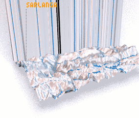 Places with similar names to Sarlangā, Iran ::
// Sarling (AT)
// Sierling (AT)
// Zeierling (AT)
// Sarling (DE)
// Zierling (DE)
// Cerlongo (IT)
// Serrallonga (ES)
// Serralongue (FR)
// Sêrlung (CN)
// Xarlung (CN)
Disclaimer :: Information on this page comes without warranty of any kind |
||
|
Where is Sarlangā? Elevation and coordinates ::
Latitude (lat): 36°41'0"N Longitude (lon): 51°6'0"E
Elevation (approx.): 37m (map arrows pan, magnifying glasses zoom) |
||
|
Visiting Sarlangā? Hotel/Accommodation ::
Book a hotel in Sarlangā Travel Guide ::
Buy a travel guide for Iran rental cars ::
car rental offers GPS waypoint ::
download a GPX waypoint (PoI) of Sarlangā for your GPS receiver
|
||