|
search place name
|
||
Shīlāndar (Iran)Shīlāndar is a town in Iran. An overview map of the region around Shīlāndar is displayed below.
regional and 3d topo map of Shīlāndar, Iran ::

Shīlāndar airports ::
The nearest airport is RAS - Rasht, located 97.6 km north east of Shīlāndar.
Other airports nearby include RZR - Ramsar (177.2 km east), SDG - Sanandaj (232.7 km south west), Nearby towns ::
Kalkash (2.6km north east) //
Gomān (3.6km north) //
Ebrāhīmābād (3.5km east) //
‘Alīābād-e Bālā (4.7km south west) //
Mazra‘eh-ye Shīlāndar (5.4km south east) //
Chalgān (6.8km south) //
Shīrmīsheh (7.4km north) //
Yeylāq-e Meydānak (7.9km south) //
Owlen Delbar (7.9km south) //
Gollījeh (8.0km south) //
Qūzlejā (6.8km east) //
Tāzeh Kand-e Ţārom (8.2km north west) //
Ţarāzūj (7.6km south east) //
Zarnī (8.4km north east) //
Qezel Dāsh (10.0km south east) //
[all distances 'as the bird flies' and approximate] 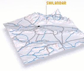 Places with similar names to Shīlāndar, Iran ::
// Chalender (US)
// Cialandaro (IT)
// Chalandar (RU)
// Chalandar (IR)
// Chilindira (ZM)
// Shelīn Dīreh (IR)
// Chālundri (PK)
// Chalandray (FR)
// Chalandry (FR)
// Chalindrey (FR)
Disclaimer :: Information on this page comes without warranty of any kind |
||
|
Where is Shīlāndar? Elevation and coordinates ::
Latitude (lat): 36°50'8"N Longitude (lon): 48°41'39"E
Elevation (approx.): 1605m (map arrows pan, magnifying glasses zoom) |
||
|
Visiting Shīlāndar? Hotel/Accommodation ::
Book a hotel in Shīlāndar Travel Guide ::
Buy a travel guide for Iran rental cars ::
car rental offers GPS waypoint ::
download a GPX waypoint (PoI) of Shīlāndar for your GPS receiver
|
||