|
search place name
|
||
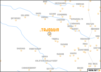
Tāj od Dīn (Khorāsān, Iran)Tāj od Dīn is a town in the Khorāsān region of Iran. An overview map of the region around Tāj od Dīn is displayed below.
regional and 3d topo map of Tāj od Dīn, Iran ::
Tāj od Dīn airports ::
The nearest airport is XBJ - Birjand, located 30.0 km south of Tāj od Dīn.
Nearby towns ::
Kalāteh-ye Pāʼīn Godār (0.0km north) //
Tāqonj (2.4km south east) //
Afzalābād (3.1km south east) //
Ghazal Dar (3.6km north west) //
Nūghāb (5.8km south east) //
Kandel (6.4km north) //
Chehrok (6.2km north east) //
Sīchān (7.5km north) //
Anīd-e Bālā (6.9km north east) //
Robāţ-e Āsaf (7.3km south west) //
Bovāj (6.9km north east) //
Bovāj (7.1km north east) //
Nūghāb (8.1km south east) //
‘Eshqābād (8.1km north east) //
Kūreh (8.6km south) //
Shīrg (8.4km north west) //
Rūshnāvand (9.1km north east) //
Bāīmār (9.7km south east) //
Māheshk (9.7km south east) //
Al Jūrak (9.7km north east) //
Khūnīk (10.2km south east) //
[all distances 'as the bird flies' and approximate]  Places with similar names to Tāj od Dīn, Iran ::
// Djedina (BA)
// Dodgetown (US)
// Tāj ed Dīn (IR)
// Tāj ed Dīn (IR)
// Tāj ed Dīn (IR)
// Tāj od Dīn (IR)
// Tejdānū (IR)
// Tajuddin (PK)
// Djidièni (ML)
// Daijiadian (CN)
Disclaimer :: Information on this page comes without warranty of any kind |
||
|
Where is Tāj od Dīn? Elevation and coordinates ::
Latitude (lat): 33°9'0"N Longitude (lon): 59°9'0"E
Elevation (approx.): 1663m (map arrows pan, magnifying glasses zoom) |
||
|
Visiting Tāj od Dīn? Hotel/Accommodation ::
Book a hotel in Tāj od Dīn Travel Guide ::
Buy a travel guide for Iran rental cars ::
car rental offers GPS waypoint ::
download a GPX waypoint (PoI) of Tāj od Dīn for your GPS receiver
|
||