|
search place name
|
||
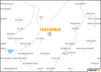
Torkambūr (Ostān-e Āz̄arbāyjān-e Sharqī, Iran)Torkambūr is a town in the Ostān-e Āz̄arbāyjān-e Sharqī region of Iran. An overview map of the region around Torkambūr is displayed below.
regional and 3d topo map of Torkambūr, Iran ::
Torkambūr airports ::
The nearest airport is TBZ - Tabriz Intl, located 55.7 km west of Torkambūr.
Nearby towns ::
 Places with similar names to Torkambūr, Iran ::
// Derkamīrī (IQ)
// Dragomir (RO)
// Dargāmāria (BD)
// Dārikāmāri (BD)
// Dorakumbura (LK)
// Dorakumbura (LK)
// Dorakumbura (LK)
// Torakumbura (LK)
// Tork Amīr (IR)
// Tor Kamar (PK)
Disclaimer :: Information on this page comes without warranty of any kind |
||
|
Where is Torkambūr? Elevation and coordinates ::
Latitude (lat): 37°58'0"N Longitude (lon): 46°50'0"E
Elevation (approx.): 1859m (map arrows pan, magnifying glasses zoom) |
||
|
Visiting Torkambūr? Hotel/Accommodation ::
Book a hotel in Torkambūr Travel Guide ::
Buy a travel guide for Iran rental cars ::
car rental offers GPS waypoint ::
download a GPX waypoint (PoI) of Torkambūr for your GPS receiver
|
||