|
search place name
|
||
Alīm Shāh (North-West Frontier, Pakistan)Alīm Shāh is a town in the North-West Frontier region of Pakistan. An overview map of the region around Alīm Shāh is displayed below.
regional and 3d topo map of Alīm Shāh, Pakistan ::

Alīm Shāh airports ::
The nearest airport is PEW - Peshawar Intl, located 123.8 km north east of Alīm Shāh.
Other airports nearby include JAA - Jalalabad (160.3 km north), PZH - Zhob (227.4 km south west), KBL - Kabul Intl (234.7 km north west), SDT - Saidu Sharif (241.4 km north east), Nearby towns ::
Kotka Malik Umar Darāz Khān (0.4km south) //
Shaikhān Bānda (0.8km east) //
Gulāp Khel (1.1km south west) //
Samand Kili (1.3km north west) //
Shahīdān Kili (1.6km north) //
Otin Khel (1.6km south west) //
Miryān Kalla (1.7km south) //
Sanzar Khel (1.8km south west) //
Ālam Sheri (1.9km south) //
Mitha Khel (2.3km north west) //
Teli Kalla (2.5km south) //
Mīri Khel (2.4km south west) //
Kotka Juma Khān (2.8km south) //
Miāngul Khel (2.9km south) //
Baran Khel (2.6km north west) //
Muhabbati Kalla (2.6km east) //
Muhabbati Kili (2.7km east) //
Painda Khān Bānda (3.1km north) //
Titar Khel Khatak (2.8km east) //
Aimal Kalla (3.2km south) //
Mandar Kili (3.1km north west) //
Kotka Hāji Mīr Sardār (3.3km south) //
Warāna Bānda (3.3km north) //
Hāji Bānda (3.2km south east) //
Kotka Ālam Gul (3.6km south) //
Abu Samand Kalla (3.5km south east) //
Mandat Khān (3.6km south) //
Shāh Salīm Kalla (3.6km south) //
Kamar Kalla (3.7km south) //
[all distances 'as the bird flies' and approximate] 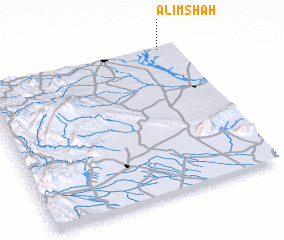 Places with similar names to Alīm Shāh, Pakistan ::
// Alamishe (RU)
// Al Masia (TD)
// Almachi (UZ)
// Ālam Shāh (PK)
// Ālam Shāh (PK)
// Alimosho (NG)
// Alumche (NG)
// Al Muţī‘ah (EG)
// Al Maʼish (SA)
// Al Miḩshāʼ (YE)
Disclaimer :: Information on this page comes without warranty of any kind |
||
|
Where is Alīm Shāh? Elevation and coordinates ::
Latitude (lat): 32°59'50"N Longitude (lon): 70°54'50"E
Elevation (approx.): 386m (map arrows pan, magnifying glasses zoom) |
||
|
Visiting Alīm Shāh? Hotel/Accommodation ::
Book a hotel in Alīm Shāh Travel Guide ::
Buy a travel guide for Pakistan rental cars ::
car rental offers GPS waypoint ::
download a GPX waypoint (PoI) of Alīm Shāh for your GPS receiver
|
||