|
search place name
|
||
Balnāra (Pakistan)Balnāra is a town in Pakistan. An overview map of the region around Balnāra is displayed below.
regional and 3d topo map of Balnāra, Pakistan ::

Balnāra airports ::
The nearest airport is MFG - Muzaffarabad, located 17.6 km south of Balnāra.
Other airports nearby include RAZ - Rawala Kot Rawalakot (75.2 km south), ISB - Islamabad Chaklala (105.7 km south west), SDT - Saidu Sharif (115.0 km west), SXR - Srinagar (126.4 km south east), Nearby towns ::
Pihāliān (0.8km south) //
Barmiār (1.1km north east) //
Dheri (1.0km west) //
Galipakhlān (1.4km north) //
Pakhlān (1.7km north) //
Lari (1.7km south) //
Gowāns (1.6km north east) //
Kalas (1.6km east) //
Hariāla (1.9km south east) //
Kalālsar (1.9km north west) //
Pahaldhar (2.1km south) //
Darār (2.2km north) //
Nāla (1.9km east) //
Sari (2.5km south) //
Khatān Bāndi (2.3km south west) //
Nalle (2.3km north east) //
Kundla (2.7km south) //
Dirgān (2.6km north west) //
Kasi (2.6km north east) //
Lūnbāla (2.5km north west) //
Prak (3.3km south) //
Bān (3.3km north) //
Pihān (2.8km north east) //
Dor (2.9km north west) //
Sādka (2.8km east) //
Batoārs (3.1km east) //
Kulbanj (3.8km south) //
Jhangri (3.8km south) //
Chauki (3.4km north east) //
[all distances 'as the bird flies' and approximate] 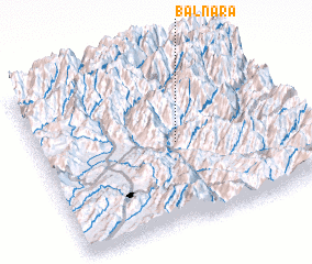 Places with similar names to Balnāra, Pakistan ::
// Balneario (ES)
// Belanera (MG)
// Bel-Nor (US)
// Bouliniéri (BJ)
// Baliniar (BF)
// Baleiniéré (TD)
// Bollenar (CL)
// Belenero (VE)
// Ballynure (JM)
// Blénoro (ML)
Disclaimer :: Information on this page comes without warranty of any kind |
||
|
Where is Balnāra? Elevation and coordinates ::
Latitude (lat): 34°29'40"N Longitude (lon): 73°32'45"E
Elevation (approx.): 1561m (map arrows pan, magnifying glasses zoom) |
||
|
Visiting Balnāra? Hotel/Accommodation ::
Book a hotel in Balnāra Travel Guide ::
Buy a travel guide for Pakistan rental cars ::
car rental offers GPS waypoint ::
download a GPX waypoint (PoI) of Balnāra for your GPS receiver
|
||