|
search place name
|
||
Dāk Chauki (Balochistān, Pakistan)Dāk Chauki is a town in the Balochistān region of Pakistan. An overview map of the region around Dāk Chauki is displayed below.
regional and 3d topo map of Dāk Chauki, Pakistan ::

Dāk Chauki airports ::
The nearest airport is PZH - Zhob, located 145.2 km north east of Dāk Chauki.
Other airports nearby include UET - Quetta (163.6 km west), SUL - Sui (186.5 km south), RYK - Rahim Yar Khan Sheikh Zayed (262.0 km south east), Nearby towns ::
Sāwal Kili (9.8km south west) //
Potoi (11.2km north east) //
[all distances 'as the bird flies' and approximate] 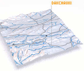 Places with similar names to Dāk Chauki, Pakistan ::
// Takoushka (RU)
// Tokoushka (RU)
// Tekeshykhy (AZ)
// Takshak (US)
// Tok-Sheykh (UA)
// Tacachico (SV)
// Tacochique (MX)
// Tequeáchic (MX)
// Tequichic (MX)
// Dāk Chauki (PK)
Disclaimer :: Information on this page comes without warranty of any kind |
||
|
Where is Dāk Chauki? Elevation and coordinates ::
Latitude (lat): 30°15'35"N Longitude (lon): 68°38'15"E
Elevation (approx.): 1481m (map arrows pan, magnifying glasses zoom) |
||
|
Visiting Dāk Chauki? Hotel/Accommodation ::
Book a hotel in Dāk Chauki Travel Guide ::
Buy a travel guide for Pakistan rental cars ::
car rental offers GPS waypoint ::
download a GPX waypoint (PoI) of Dāk Chauki for your GPS receiver
|
||