|
search place name
|
||
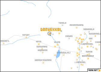
Darwekkai (Federally Administered Tribal Areas, Pakistan)Darwekkai is a town in the Federally Administered Tribal Areas region of Pakistan. An overview map of the region around Darwekkai is displayed below.
regional and 3d topo map of Darwekkai, Pakistan ::
Darwekkai airports ::
The nearest airport is JAA - Jalalabad, located 70.7 km north east of Darwekkai.
Other airports nearby include KBL - Kabul Intl (91.8 km north west), PEW - Peshawar Intl (147.4 km east), Nearby towns ::
Gūjarghūna (1.0km north east) //
Durrāni (2.0km north) //
Mīrmai (2.8km east) //
Alīzai (3.9km south east) //
Ali Mangal Post (4.1km south) //
Kotri (4.7km south west) //
Kotkar (5.1km south east) //
Sūrsurang (5.5km south west) //
Toi Mela (5.4km north east) //
Haqdarra (6.6km south) //
Khewas (5.8km east) //
Rāgha (7.2km south) //
Shandigul Kili (8.2km south east) //
[all distances 'as the bird flies' and approximate]  Places with similar names to Darwekkai, Pakistan ::
Disclaimer :: Information on this page comes without warranty of any kind |
||
|
Where is Darwekkai? Elevation and coordinates ::
Latitude (lat): 33°58'57"N Longitude (lon): 69°55'9"E
Elevation (approx.): 2509m (map arrows pan, magnifying glasses zoom) |
||
|
Visiting Darwekkai? Hotel/Accommodation ::
Book a hotel in Darwekkai Travel Guide ::
Buy a travel guide for Pakistan rental cars ::
car rental offers GPS waypoint ::
download a GPX waypoint (PoI) of Darwekkai for your GPS receiver
|
||