|
search place name
|
||
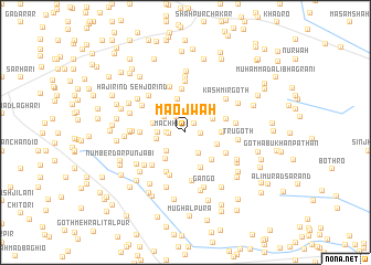
Maojwāh (Sind, Pakistan)Maojwāh is a town in the Sind region of Pakistan. An overview map of the region around Maojwāh is displayed below.
regional and 3d topo map of Maojwāh, Pakistan ::
Maojwāh airports ::
The nearest airport is WNS - Nawabshah, located 30.7 km north west of Maojwāh.
Other airports nearby include BDN - Talhar (135.5 km south), MJD - Moenjodaro (150.5 km north), SKZ - Sukkur (185.9 km north), KHI - Karachi Jinnah Intl (194.9 km south west), Nearby towns ::
Ghulām Mustafa Sanjrāni (1.2km north east) //
Nichāio Bhānojo (1.4km east) //
Mithu Shaikh (1.5km west) //
Moro Dāhri (1.8km north west) //
Machhi (1.7km west) //
Bachal Jhalu (1.9km north) //
Hāshim Khān Dāhri (2.0km north) //
Ghulām Muhammād Bāgrāni (2.5km south east) //
Sumer (2.5km south west) //
Karamullāh Dāhri (2.5km north east) //
Sache Dino Solangi (2.5km north west) //
Lemon Sanjrāni (2.5km west) //
Muhabbat Khān Rind (2.7km west) //
Hāji Budho (2.9km north east) //
Nūr Muhammād Chutto (3.2km south west) //
Allāh Warāya Pinjāro (3.1km west) //
Tru Bhānojo (3.2km south east) //
Bhāi Khān Dāhri (3.5km north) //
Sultān (3.3km east) //
Sarhori (3.3km east) //
Bachal Khān Bhāgrāni (3.6km south east) //
Wali Muhammād Lishāri (3.8km south) //
Bakhsh Ali Rind (4.3km north) //
Khān Sahjrāni (4.0km east) //
Ali Muhammad Brāhui (4.3km south west) //
Khamīso Brāhui (4.5km south) //
Miān Ghulām Shāh (4.2km west) //
Bachal Khān Hangora (4.3km south east) //
Ghāzi Lishāri (4.6km south west) //
[all distances 'as the bird flies' and approximate]  Places with similar names to Maojwāh, Pakistan ::
Disclaimer :: Information on this page comes without warranty of any kind |
||
|
Where is Maojwāh? Elevation and coordinates ::
Latitude (lat): 26°3'0"N Longitude (lon): 68°38'0"E
Elevation (approx.): 26m (map arrows pan, magnifying glasses zoom) |
||
|
Visiting Maojwāh? Hotel/Accommodation ::
Book a hotel in Maojwāh Travel Guide ::
Buy a travel guide for Pakistan rental cars ::
car rental offers GPS waypoint ::
download a GPX waypoint (PoI) of Maojwāh for your GPS receiver
|
||