|
search place name
|
||
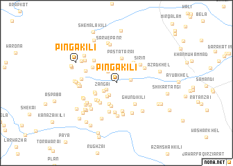
Pinga Kili (Federally Administered Tribal Areas, Pakistan)Pinga Kili is a town in the Federally Administered Tribal Areas region of Pakistan. An overview map of the region around Pinga Kili is displayed below.
regional and 3d topo map of Pinga Kili, Pakistan ::
Pinga Kili airports ::
The nearest airport is PZH - Zhob, located 165.5 km south west of Pinga Kili.
Other airports nearby include PEW - Peshawar Intl (184.4 km north east), JAA - Jalalabad (197.2 km north), KBL - Kabul Intl (241.6 km north west), Nearby towns ::
Mārezghāra (1.7km south west) //
Lakai (2.2km south west) //
Gardai (2.2km north west) //
Khurpai (2.0km east) //
Sara Tangi (2.4km north) //
Zangai (2.2km south west) //
Waredāno Kach (2.4km north west) //
Senai Ghundai (2.5km south west) //
Ashkarai (3.1km north east) //
Tor Rāghzai Kili (3.5km south) //
Tindo Kas (3.8km south) //
Mangar Kili (3.3km south west) //
Dabak (3.4km south west) //
Pasta Tarai (4.1km north) //
Khadar Ziārat (3.9km south west) //
Ezhdangai (3.8km south west) //
Mārūf Khel (4.0km north east) //
Chigālīar (3.9km south west) //
Ghundi Kili (4.2km south east) //
Mullāgāno Kas (4.1km north west) //
Qalandar Khel (4.6km south) //
Surat Khān Kili (4.8km south) //
Ghoryasa (4.7km south) //
Sirin (4.4km north east) //
Kūi (4.5km north east) //
Raghzi Sar (4.7km north west) //
Kwate Khwa Kili (5.2km south) //
Chīchandi Khulah (4.6km north west) //
Mach Kili (5.3km south) //
[all distances 'as the bird flies' and approximate]  Places with similar names to Pinga Kili, Pakistan ::
// Pāngkala (MM)
// Pongkalau (MM)
// Pene-Kikili (CD)
// Pangkola (ID)
// Pengkol (ID)
// Pengkol (ID)
// Pengkol (ID)
// Pungkol (ID)
// Pinga Kili (PK)
// Punga Kili (PK)
Disclaimer :: Information on this page comes without warranty of any kind |
||
|
Where is Pinga Kili? Elevation and coordinates ::
Latitude (lat): 32°37'27"N Longitude (lon): 70°23'31"E
Elevation (approx.): 793m (map arrows pan, magnifying glasses zoom) |
||
|
Visiting Pinga Kili? Hotel/Accommodation ::
Book a hotel in Pinga Kili Travel Guide ::
Buy a travel guide for Pakistan rental cars ::
car rental offers GPS waypoint ::
download a GPX waypoint (PoI) of Pinga Kili for your GPS receiver
|
||