|
search place name
|
||
Sher Khān (North-West Frontier, Pakistan)Sher Khān is a town in the North-West Frontier region of Pakistan. An overview map of the region around Sher Khān is displayed below.
regional and 3d topo map of Sher Khān, Pakistan ::

Sher Khān airports ::
The nearest airport is PEW - Peshawar Intl, located 147.5 km north east of Sher Khān.
Other airports nearby include JAA - Jalalabad (176.1 km north), PZH - Zhob (203.4 km south west), KBL - Kabul Intl (240.1 km north west), SDT - Saidu Sharif (265.4 km north east), Nearby towns ::
Bakhtiār Khān (0.4km north east) //
Mehrdil (0.7km north) //
Sultānābād (0.9km north east) //
Maulādād (1.0km north east) //
Gidar Kalai (0.9km east) //
Sher Khān Īsa Khel (1.5km south) //
Mīr Ālam Khān (1.5km north west) //
Nār Mir Abbās Shāh (1.4km north west) //
Khā Sardār Kalai (1.4km south east) //
Gharībābād (1.6km north) //
Chandu Rām (1.6km east) //
Marwat (1.7km west) //
Faqīr Muhammad Masūm (1.8km south west) //
Sikandar Khān (1.7km east) //
Nār Hāfizābād (2.1km north) //
Alladād Mughal Khel (2.0km south east) //
Samandar (2.1km north west) //
Samandar Khān (2.2km north west) //
Ibrāhīm Khān (2.3km north west) //
Abdu Karīm Khān (2.2km south west) //
Atu Rām (2.5km south west) //
Kamalo (2.8km south) //
Abu Samand Begu Khel (2.6km south east) //
Foujdār (2.4km east) //
Sāhib Khān (2.8km south) //
Kuli Khān Pasanni (2.9km south) //
Akbar Ali Khān (2.9km north west) //
Āsa Nand (2.7km south west) //
Asu Rām (2.7km south west) //
[all distances 'as the bird flies' and approximate] 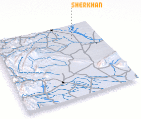 Places with similar names to Sher Khān, Pakistan ::
// Chorakkhāneh (IR)
// Char Khuni (BD)
// Chārukhān (BD)
// Char-Khana (UZ)
// Shahrikhon (UZ)
// Shurakhan (UZ)
// Shīr Khān (IR)
// Shīr Khān (IR)
// Shīr Khān (IR)
// Shīr Khān (IR)
Disclaimer :: Information on this page comes without warranty of any kind |
||
|
Where is Sher Khān? Elevation and coordinates ::
Latitude (lat): 32°49'36"N Longitude (lon): 70°45'17"E
Elevation (approx.): 305m (map arrows pan, magnifying glasses zoom) |
||
|
Visiting Sher Khān? Hotel/Accommodation ::
Book a hotel in Sher Khān Travel Guide ::
Buy a travel guide for Pakistan rental cars ::
car rental offers GPS waypoint ::
download a GPX waypoint (PoI) of Sher Khān for your GPS receiver
|
||