|
search place name
|
||
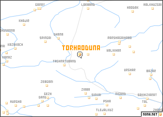
Tor Haoduna (Balochistān, Pakistan)Tor Haoduna is a town in the Balochistān region of Pakistan. An overview map of the region around Tor Haoduna is displayed below.
regional and 3d topo map of Tor Haoduna, Pakistan ::
Tor Haoduna airports ::
The nearest airport is UET - Quetta, located 118.0 km south west of Tor Haoduna.
Other airports nearby include KDH - Kandahar (171.7 km west), PZH - Zhob (178.8 km east), Nearby towns ::
Speratara (1.6km north east) //
Taghratu Band (3.8km south west) //
Dhāna (6.5km north west) //
Wali Khān (6.4km east) //
Ziāba (8.1km south) //
Spīngai (8.1km north west) //
Tsogai Shabān (8.1km north east) //
Parshagai Hābo (8.5km north east) //
Zebgari (9.2km south west) //
[all distances 'as the bird flies' and approximate]  Places with similar names to Tor Haoduna, Pakistan ::
// Tarhatine (MA)
// Dreihütten (AT)
// Trahütten (AT)
// Tirhedouine (MA)
// Drahotín (CZ)
// Drhotín (CZ)
// Dyrheden (DK)
// Yttre Hedane (SE)
// Yttre Heden (SE)
// Dreihütten (BE)
Disclaimer :: Information on this page comes without warranty of any kind |
||
|
Where is Tor Haoduna? Elevation and coordinates ::
Latitude (lat): 31°8'50"N Longitude (lon): 67°36'10"E
Elevation (approx.): 2408m (map arrows pan, magnifying glasses zoom) |
||
|
Visiting Tor Haoduna? Hotel/Accommodation ::
Book a hotel in Tor Haoduna Travel Guide ::
Buy a travel guide for Pakistan rental cars ::
car rental offers GPS waypoint ::
download a GPX waypoint (PoI) of Tor Haoduna for your GPS receiver
|
||