|
search place name
|
||
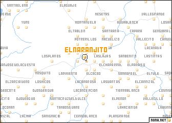
El Naranjito (Comayagua, Honduras)El Naranjito is a town in the Comayagua region of Honduras. An overview map of the region around El Naranjito is displayed below.
regional and 3d topo map of El Naranjito, Honduras ::
El Naranjito airports ::
The nearest airport is SAP - San Pedro Sula La Mesa Intl, located 75.6 km north of El Naranjito.
Other airports nearby include TGU - Tegucigalpa Toncontin Intl (100.6 km south east), TEA - Tela (114.7 km north), LCE - La Ceiba Goloson Intl (145.8 km north east), SAL - San Salvador El Salvador Intl (202.3 km south west), Nearby towns ::
El Cedral (0.0km north) //
Maragua (1.8km east) //
Meámbar (1.8km east) //
El Jicarito (1.8km east) //
Pueblo Nuevo (1.9km south) //
El Potrero (1.9km north) //
Simbra (1.8km west) //
Mata Palo (2.6km south east) //
Los Potrerillos (2.6km south east) //
El Rosario (2.6km north east) //
Los Globos (2.6km north west) //
Las Lajas (3.6km east) //
Dolores (3.6km east) //
Potrerillos (3.7km north) //
El Cacao (4.1km south east) //
Santa Rosa (4.0km north east) //
Los Clovos (4.1km north west) //
Cerrón (4.1km north west) //
Cienegal (4.0km north west) //
La Pimienta (5.2km south west) //
La Mesa (5.4km east) //
Las Mesas (5.4km east) //
La Capa Rosa (5.6km south) //
El Chaparral (5.7km east) //
El Tablón (5.8km north) //
El Chomo (6.6km north east) //
Macuelizo (6.5km north east) //
Las Mestizas (7.2km east) //
La Concepción (7.4km south) //
[all distances 'as the bird flies' and approximate] 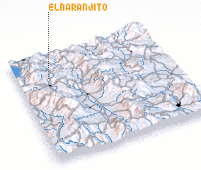 Places with similar names to El Naranjito, Honduras ::
// El Naranjito (PA)
// El Naranjito (SV)
// El Naranjito (SV)
// El Naranjito (MX)
// El Naranjito (MX)
// El Naranjito (MX)
// El Naranjito (MX)
// El Naranjito (MX)
// El Naranjito (HN)
// El Naranjito (HN)
Disclaimer :: Information on this page comes without warranty of any kind |
||
|
Where is El Naranjito? Elevation and coordinates ::
Latitude (lat): 14°47'0"N Longitude (lon): 87°47'0"W
Elevation (approx.): 668m (map arrows pan, magnifying glasses zoom) |
||
|
Visiting El Naranjito? Hotel/Accommodation ::
Book a hotel in El Naranjito Travel Guide ::
Buy a travel guide for Honduras rental cars ::
car rental offers GPS waypoint ::
download a GPX waypoint (PoI) of El Naranjito for your GPS receiver
|
||