|
search place name
|
||
Saracarán (Francisco Morazán, Honduras)Saracarán is a town in the Francisco Morazán region of Honduras. An overview map of the region around Saracarán is displayed below.
regional and 3d topo map of Saracarán, Honduras ::

Saracarán airports ::
The nearest airport is TGU - Tegucigalpa Toncontin Intl, located 25.8 km north east of Saracarán.
Other airports nearby include SAP - San Pedro Sula La Mesa Intl (176.7 km north), SAL - San Salvador El Salvador Intl (185.5 km west), TEA - Tela (204.0 km north), LCE - La Ceiba Goloson Intl (209.2 km north), Nearby towns ::
El Potrerito (1.8km east) //
Las Ciénegas (2.6km north east) //
San Francisco (2.6km north east) //
Los Quebrachos (2.6km north east) //
El Zarzal (2.6km north east) //
La Guadalupe (4.0km south west) //
Agua Blanca (4.0km south east) //
El Zopilote (5.2km north east) //
El Carrizal (5.2km north east) //
El Paraíso (5.2km north east) //
La Campana (5.8km south) //
Los Tablones (6.6km north east) //
Guachipilín (6.5km north east) //
Copantillo (6.5km north east) //
El Aguacatal (6.5km north east) //
Canyuco (7.2km east) //
El Llano (7.2km east) //
El Rancho (7.2km east) //
Juan García (7.2km east) //
La Granadilla (7.2km east) //
Las Marías (7.7km south west) //
Mulhuaca (7.7km north west) //
El Junquillo (8.1km south west) //
Surcos de Caña (8.1km north east) //
Las Ceniceras (8.1km north east) //
Guasucarán (9.2km south east) //
Cerro Verde (9.2km north west) //
Petacones (10.3km south west) //
La Piedra Herrada (10.3km south west) //
[all distances 'as the bird flies' and approximate] 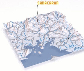 Places with similar names to Saracarán, Honduras ::
// Zǝrgǝran (AZ)
// Sirikárion (GR)
// Sargarān (IQ)
// Sarkarān (IR)
// Zargarān (IR)
// Zargarān (IR)
// Zargarān (IR)
// Zargarān (IR)
// Sarkāorān (PK)
// Sro Korūna (PK)
Disclaimer :: Information on this page comes without warranty of any kind |
||
|
Where is Saracarán? Elevation and coordinates ::
Latitude (lat): 13°56'0"N Longitude (lon): 87°25'0"W
Elevation (approx.): 1115m (map arrows pan, magnifying glasses zoom) |
||
|
Visiting Saracarán? Hotel/Accommodation ::
Book a hotel in Saracarán Travel Guide ::
Buy a travel guide for Honduras rental cars ::
car rental offers GPS waypoint ::
download a GPX waypoint (PoI) of Saracarán for your GPS receiver
|
||