|
search place name
|
||
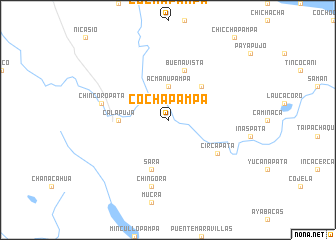
Cochapampa (Puno, Peru)Cochapampa is a town in the Puno region of Peru. An overview map of the region around Cochapampa is displayed below.
regional and 3d topo map of Cochapampa, Peru ::
Cochapampa airports ::
The nearest airport is JUL - Juliaca, located 16.7 km south of Cochapampa.
Other airports nearby include AQP - Arequipa Rodriguez Ballon (189.4 km south west), LPB - La Paz El Alto Intl (249.5 km south east), CUZ - Cuzco Teniente Alejandro Velasco Astete Intl (274.5 km north west), Nearby towns ::
Acmanupampa (3.7km north) //
Piyojo (5.1km north east) //
Calapuja (5.4km west) //
Sara (5.8km south) //
Buena Vista (5.8km north) //
Achaya (5.8km north) //
Circapata (6.5km south east) //
Chingora (7.6km south) //
Chincoropata (7.4km west) //
[all distances 'as the bird flies' and approximate] 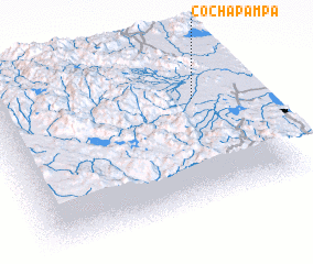 Places with similar names to Cochapampa, Peru ::
// Cachipampa (PE)
// Cachipampa (PE)
// Cachipampa (PE)
// Cachipampa (PE)
// Casha Pampa (PE)
// Casha Pampa (PE)
// Cocha Pampa (PE)
// Cochapampa (PE)
// Cochapampa (PE)
// Cochapampa (PE)
Disclaimer :: Information on this page comes without warranty of any kind |
||
|
Where is Cochapampa? Elevation and coordinates ::
Latitude (lat): 15°19'0"S Longitude (lon): 70°10'0"W
Elevation (approx.): 3836m (map arrows pan, magnifying glasses zoom) |
||
|
Visiting Cochapampa? Hotel/Accommodation ::
Book a hotel in Cochapampa Travel Guide ::
Buy a travel guide for Peru rental cars ::
car rental offers GPS waypoint ::
download a GPX waypoint (PoI) of Cochapampa for your GPS receiver
|
||