|
search place name
|
||
Puente María (Huánuco, Peru)Puente María is a town in the Huánuco region of Peru. An overview map of the region around Puente María is displayed below.
regional and 3d topo map of Puente María, Peru ::

Puente María airports ::
The nearest airport is ATA - Anta Comandante Fap German Arias Graziani, located 149.9 km west of Puente María.
Other airports nearby include PCL - Pucallpa Cap Fap David Abenzur Rengifo Intl (205.5 km north east), Nearby towns ::
Taso Grande (3.1km west) //
Manchuria (6.9km east) //
[all distances 'as the bird flies' and approximate] 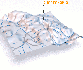 Places with similar names to Puente María, Peru ::
// Ponte Maira (IT)
// Pontemieiro (PT)
// Punda Maria (ZA)
// Pind Mahri (PK)
// Pandembere (MZ)
// Pontaumur (FR)
// Pā'īn Dāmīr (IR)
// Punta Maria (PH)
// Punta Miray (PH)
// Pindimar (AU)
Disclaimer :: Information on this page comes without warranty of any kind |
||
|
Where is Puente María? Elevation and coordinates ::
Latitude (lat): 9°13'0"S Longitude (lon): 76°14'27"W
Elevation (approx.): 795m (map arrows pan, magnifying glasses zoom) |
||
|
Visiting Puente María? Hotel/Accommodation ::
Book a hotel in Puente María Travel Guide ::
Buy a travel guide for Peru rental cars ::
car rental offers GPS waypoint ::
download a GPX waypoint (PoI) of Puente María for your GPS receiver
|
||