|
search place name
|
||
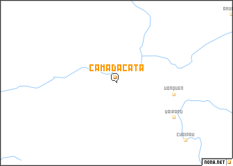
Camadacatá (Bolívar, Venezuela)Camadacatá is a town in the Bolívar region of Venezuela. An overview map of the region around Camadacatá is displayed below.
regional and 3d topo map of Camadacatá, Venezuela ::
Camadacatá airports ::
The nearest airport is CAJ - Canaima, located 164.7 km north west of Camadacatá.
Nearby towns ::
[all distances 'as the bird flies' and approximate] 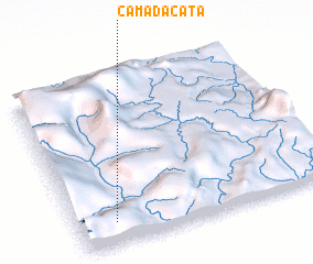 Places with similar names to Camadacatá, Venezuela ::
// Comadcad (PH)
// Cumadcad (PH)
// Gammeddegoda (LK)
// Gammeddegoda (LK)
// Camatagüita (VE)
// Kami-takada (JP)
// Gumtäkt (FI)
// Cambadacata (AO)
Disclaimer :: Information on this page comes without warranty of any kind |
||
|
Where is Camadacatá? Elevation and coordinates ::
Latitude (lat): 5°8'0"N Longitude (lon): 61°51'0"W
Elevation (approx.): 848m (map arrows pan, magnifying glasses zoom) |
||
|
Visiting Camadacatá? Hotel/Accommodation ::
Book a hotel in Camadacatá Travel Guide ::
Buy a travel guide for Venezuela rental cars ::
car rental offers GPS waypoint ::
download a GPX waypoint (PoI) of Camadacatá for your GPS receiver
|
||