|
search place name
|
||
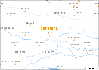
Guasimal (Apure, Venezuela)Guasimal is a town in the Apure region of Venezuela. An overview map of the region around Guasimal is displayed below.
regional and 3d topo map of Guasimal, Venezuela ::
Guasimal airports ::
The nearest airport is SFD - San Fernando De Apure, located 54.2 km east of Guasimal.
Other airports nearby include PCR - Puerto Carreno (173.5 km south), GUQ - Guanare (251.6 km north west), AGV - Acarigua Oswaldo Guevara Mujica (252.4 km north west), VDP - Valle De La Pascua (269.1 km north east), Nearby towns ::
Paso Real Payara (0.0km north) //
Caño Seco (5.2km south west) //
Si Pudiere (7.4km south) //
Jabillal (8.2km north west) //
Biruaquita (8.3km north east) //
[all distances 'as the bird flies' and approximate]  Places with similar names to Guasimal, Venezuela ::
// Kasymly (AZ)
// Kazımlı (AZ)
// Qasimbǝyli (AZ)
// Qasımbǝyli (AZ)
// Qasımbǝyli (AZ)
// Qasımbeyli (AZ)
// Qasımlı (AZ)
// Qasımlı (AZ)
// Keys Mill (US)
// Gosaumühle (AT)
Disclaimer :: Information on this page comes without warranty of any kind |
||
|
Where is Guasimal? Elevation and coordinates ::
Latitude (lat): 7°42'0"N Longitude (lon): 67°54'0"W
Elevation (approx.): 58m (map arrows pan, magnifying glasses zoom) |
||
|
Visiting Guasimal? Hotel/Accommodation ::
Book a hotel in Guasimal Travel Guide ::
Buy a travel guide for Venezuela rental cars ::
car rental offers GPS waypoint ::
download a GPX waypoint (PoI) of Guasimal for your GPS receiver
|
||