|
search place name
|
||
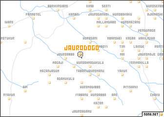
Jauro Dogo (Gongola, Nigeria)Jauro Dogo is a town in the Gongola region of Nigeria. An overview map of the region around Jauro Dogo is displayed below.
regional and 3d topo map of Jauro Dogo, Nigeria ::
Jauro Dogo airports ::
The nearest airport is YOL - Yola, located 141.4 km north east of Jauro Dogo.
Nearby towns ::
Wuro Ahmadu Kulu (2.6km south east) //
Jauro Nyama (2.6km south west) //
Jauro Duvo (2.6km south west) //
Jauro Abba (3.7km west) //
Wuro Sani (4.1km north east) //
Fan Petel (4.1km south east) //
Mallam Boyi (4.1km north east) //
Tabari Jauro Manu (4.1km south east) //
Dam (5.2km south east) //
Jauro Majo (5.6km south) //
Jauro Mashi (5.8km west) //
Magaji (5.8km west) //
Adamu Kulu (6.7km south west) //
Wuro Modibbo (7.6km south) //
Mazan Jadum (8.2km south west) //
Mbarowei (8.2km north east) //
Jauro Shomwa (8.3km north east) //
Jauro Jalo (8.3km north east) //
Jauro Sent (8.3km north east) //
Mallam Dabo (9.2km north east) //
Jauro Wala (9.2km south west) //
[all distances 'as the bird flies' and approximate] 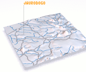 Places with similar names to Jauro Dogo, Nigeria ::
Disclaimer :: Information on this page comes without warranty of any kind |
||
|
Where is Jauro Dogo? Elevation and coordinates ::
Latitude (lat): 8°45'0"N Longitude (lon): 11°15'0"E
Elevation (approx.): 217m (map arrows pan, magnifying glasses zoom) |
||
|
Visiting Jauro Dogo? Hotel/Accommodation ::
Book a hotel in Jauro Dogo Travel Guide ::
Buy a travel guide for Nigeria rental cars ::
car rental offers GPS waypoint ::
download a GPX waypoint (PoI) of Jauro Dogo for your GPS receiver
|
||