|
search place name
|
||
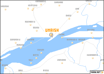
Umaish (Nassarawa, Nigeria)Umaish is a town in the Nassarawa region of Nigeria. An overview map of the region around Umaish is displayed below.
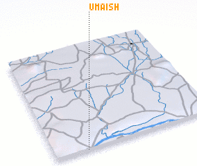
regional and 3d topo map of Umaish, Nigeria ::
Umaish airports ::
The nearest airport is ABV - Abuja Nnamdi Azikiwe Intl, located 111.3 km north of Umaish.
Other airports nearby include MDI - Makurdi (159.3 km east), ENU - Enugu (173.6 km south), MXJ - Minna New (199.8 km north west), AKR - Akure (225.7 km west), Nearby towns ::
 Places with similar names to Umaish, Nigeria ::
// Umachua (BO)
// Umbach (AT)
// Umbach (AT)
// Umecho (ET)
// Umsiai (ID)
// Umm Būshah (SD)
// Umm Būshah (SD)
// Umuchi (PE)
// Umuchu (NG)
// Umu Echi (NG)
Disclaimer :: Information on this page comes without warranty of any kind |
||
|
Where is Umaish? Elevation and coordinates ::
Latitude (lat): 8°0'7"N Longitude (lon): 7°12'3"E
Elevation (approx.): 43m (map arrows pan, magnifying glasses zoom) |
||
|
Visiting Umaish? Hotel/Accommodation ::
Book a hotel in Umaish Travel Guide ::
Buy a travel guide for Nigeria rental cars ::
car rental offers GPS waypoint ::
download a GPX waypoint (PoI) of Umaish for your GPS receiver
|
||